
Mexico Faces Dangerous Hurricane Polo as Guerrero and Michoacán Brace for Flooding and Coastal Threats
Source Mexico Tourism Mexico faces dangerous Hurricane Polo as Guerrero and Michoacán brace for flooding and coastal threats, with the powerful Pacif

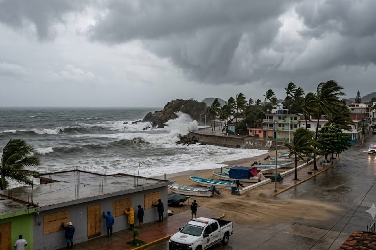
Image generated by AI
Source Mexico Tourism
Mexico faces dangerous Hurricane Polo as Guerrero and Michoacán brace for flooding and coastal threats, with the powerful Pacific hurricane remaining close enough to southwestern Mexico to bring intense rainfall, dangerous surf, strong winds and the possibility of life-threatening flash floods and mudslides even while its centre remains offshore.
Polo underwent extraordinary rapid intensification after developing south of Mexico, reaching Category 5 strength on 22 September. Although its maximum sustained winds had fallen to around 155 mph, or 250 km/h, early on 23 September, the storm remained a major Category 4 hurricane and continued to pose serious hazards to communities and travellers along Mexico’s southwestern Pacific coast.
Hurricane Polo Remains a Powerful Major Hurricane
Polo strengthened at remarkable speed after initially developing as a tropical system south of Mexico.
By 21 September, the storm had become a hurricane. During the following day, it intensified into a Category 5 system, the highest level on the Saffir-Simpson Hurricane Wind Scale.
A NOAA Hurricane Hunter aircraft investigating Polo on 22 September measured conditions that prompted forecasters to estimate maximum sustained winds of 180 mph, or 285 km/h, at one stage.
Its minimum central pressure fell to approximately 892 millibars during that period of extreme intensity.
By 3 a.m. CST on 23 September, Polo’s winds had decreased to 155 mph, placing it back within Category 4 strength. However, weakening from Category 5 did not remove the danger.
Hurricane Polo Latest Key Figures Indicator NHC Information Date and time 23 September 2026, 3 a.m. CST Maximum sustained winds 155 mph / 250 km/h Hurricane category Category 4 Position About 185 miles south of Zihuatanejo Distance from Manzanillo About 335 miles southeast Movement North at 2 mph Central pressure 918 mb Earlier peak wind 180 mph / 285 km/h Earlier minimum pressure About 892 mb
Polo was moving extremely slowly, which adds another element of concern because its rainbands and ocean swells can affect the same coastal areas for an extended period.
Guerrero and Michoacán Face the Greatest Rainfall Danger
The most immediate threat to populated areas may come from water rather than Polo’s strongest core winds.
Forecasters expect 3 to 6 inches of rain across coastal sections of Guerrero and Michoacán through Thursday, with isolated totals reaching as much as 8 inches.
Mexico's national meteorological service has issued a warning for Hurricane Polo, which is expected to bring heavy rainfall and strong winds to the coastal states of Guerrero and Michoacán. The National Hurricane Center is closely monitoring the storm's progress and providing updates on its projected path and intensity. As the storm approaches, residents and tourists are advised to take necessary precautions and follow evacuation orders if issued.
Such rainfall can become particularly dangerous in mountainous terrain.
Heavy rain falling over steep slopes can rapidly produce flash flooding and mudslides, while rivers and streams can rise with little warning.
The threat is therefore not confined to beaches or locations immediately beside the Pacific Ocean.
Residents and travellers farther inland need to monitor conditions where mountainous terrain increases landslide risk.
Oaxaca Colima and Jalisco Could Also Receive Heavy Rain
Polo’s effects extend beyond Guerrero and Michoacán.
Coastal parts of Oaxaca, Colima and Jalisco could receive approximately 2 to 4 inches of rain through Thursday.
The broad geographical footprint means travellers should not judge their risk solely by looking at the hurricane’s eye on a map.
Main Weather Threats by Area Mexican State Main Expected Threat Guerrero Heavy rain, flooding, mudslides, surf and strong winds Michoacán Heavy rain, flooding, mudslides and dangerous coastal conditions Oaxaca Heavy rainfall and elevated coastal conditions Colima Heavy rain and dangerous surf Jalisco Rainfall and deteriorating coastal conditions
Forecast totals can change as Polo moves, so travellers and residents should continue following official updates.
Tropical Storm Warning Covers Part of Mexico’s Coast
A Tropical Storm Warning remains in force from Tecpan de Galeana to Punta San Telmo.
A warning means tropical-storm conditions are expected somewhere within the specified area.
A Tropical Storm Watch has also extended westward from Punta San Telmo towards Playa Pérula, reflecting the possibility of tropical-storm conditions reaching additional parts of the coast.
Airlines operating in Mexico, such as Aeromexico, have begun to issue travel alerts and waivers for passengers affected by the hurricane. For example, Aeromexico's official website (www.aeromexico.com) provides information on flight disruptions, rebooking options, and travel restrictions. Passengers are advised to check with their airline for the latest updates and to plan accordingly.
Polo’s strongest hurricane-force winds remain concentrated around its centre offshore, but outer rainbands have begun reaching southwestern Mexico.
That distinction is important. A hurricane does not need to make direct landfall for coastal communities to experience dangerous conditions.
Dangerous Surf and Rip Currents Threaten the Pacific Coast
Ocean conditions represent another major hazard.
Large swells generated by Polo are expected to affect sections of southwestern Mexico’s coastline during the coming days.
These swells can produce:
Life-threatening surf Powerful rip currents Coastal flooding Dangerous conditions for small vessels Difficult conditions around beaches and exposed coastal areas
Travellers should therefore avoid interpreting offshore movement as a sign that beaches are safe.
A hurricane hundreds of kilometres offshore can still generate extremely hazardous marine conditions along the coast.
Polo Reached Category 5 After Explosive Intensification
Polo’s development has been notable because of the speed at which it strengthened.
At 9 a.m. CST on 21 September, Polo was still a tropical storm with maximum sustained winds of approximately 65 mph.
Only around 24 hours later, it had become an extremely dangerous Category 5 hurricane with winds near 165 mph.
Later on 22 September, Hurricane Hunter observations supported an increase to approximately 180 mph.
The Mexican government's tourism board, SECTUR, is working closely with local authorities to ensure the safety of tourists and minimize the impact of the hurricane on the tourism industry. The board is providing updates on affected areas, evacuation routes, and emergency services, and is advising tourists to follow local instructions and stay informed through official channels. Additionally, the Mexican Ministry of Interior is coordinating relief efforts and providing support to affected communities.
That represents a dramatic increase in wind speed over a very short period.
Time Polo’s Approximate Maximum Winds 21 Sept, 9 a.m. CST 65 mph 21 Sept, noon CST 80 mph 22 Sept, midnight CST 130 mph 22 Sept, 6 a.m. CST 160 mph 22 Sept, 3 p.m. CST 180 mph 23 Sept, 3 a.m. CST 155 mph
The figures show just how rapidly tropical cyclone conditions can change.
No Verified Basis Yet to Attribute Polo Specifically to El Niño
Early descriptions of Polo have linked its strength to unusually warm ocean conditions and El Niño.
That connection requires caution.
The National Hurricane Center has described Polo’s atmospheric environment as highly favourable for strengthening, but its current official discussions do not establish that El Niño directly caused Polo’s rapid intensification.
Hurricane intensity depends on several interacting factors, including ocean heat, atmospheric moisture, wind shear and the internal structure of the cyclone.
For that reason, attributing Polo’s exceptional strength specifically to El Niño would go beyond the evidence presented in the official hurricane advisories currently available.
Travel Along Southwestern Mexico Could Face Disruption
Polo’s proximity to important Pacific tourism areas also makes the storm significant for travellers.
Zihuatanejo and the wider Guerrero coast are among the areas closest to the hurricane’s circulation.
Even without a direct strike, severe rain, flooding, landslides, rough seas and strong winds can affect road journeys and local tourism activity.
Travellers should monitor:
Airline notifications Airport operating information Hotel communications Road closures Local emergency warnings Tour and excursion cancellations Marine restrictions Beach closures
Anyone already in an affected destination should follow instructions issued by Mexican civil protection authorities rather than relying exclusively on travel itineraries or weather applications.
Road Travel Could Become Particularly Difficult
Heavy rainfall can have serious consequences for road transport in mountainous parts of southwestern Mexico.
Flooding may make low
FAQ: Mexico Faces Dangerous Hurricane Polo as 2026
Will my flight be canceled due to Hurricane Polo? Check with your airline for updates and possible cancellations.
Are tourist areas in Guerrero and Michoacán safe? Avoid coastal areas and follow local authorities' instructions.
Can I travel to Mexico during Hurricane Polo? Postpone travel to affected areas until the storm passes.
What should I do if I'm already in the affected area? Follow evacuation orders and stay informed through local news.
Related Travel Guides
- Türkiye Teams Up Canada To Create A Cross Continental Tourism And Trade Corridor With Fresh Growth Opportunities
- Maldives Partners With China To Strengthen Sustainable Tourism As Fisheries And Marine Innovation Expand
- Canada And St. Kitts Steps Up Tourism Collaboration As Island Destination Targets More Canadian Travellers
Disclaimer
This article is for informational and educational purposes only. It does not constitute legal, financial, or professional advice. While we strive to provide accurate and up-to-date information, travel policies, regulations, and conditions change rapidly. Always verify information with official sources before making travel decisions. Nomad Lawyer makes no representations about the accuracy, reliability, completeness, or suitability of the information provided. Readers should consult qualified professionals for advice specific to their circumstances. The views expressed in this article are those of the author and do not necessarily reflect the views of Nomad Lawyer.
Raushan Kumar
Founder & Lead Developer
Full-stack developer with 11+ years of experience and a passionate traveller. Raushan built Nomad Lawyer from the ground up with a vision to create the best travel and law experience on the web.
Learn more about our team →