
Indonesia Closes 7 Airports as Anak Krakatau Ash Disrupts 2,961 Flights

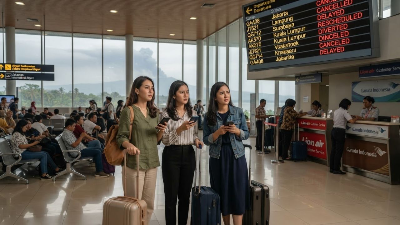
Indonesian transportation authorities have extended precautionary closures across seven airports through 11:59 p.m. local time on September 7 as volcanic ash clouds from Anak Krakatau rising to 15,000 feet disrupted 2,961 flights and affected approximately 341,000 passengers across Java and Sumatra. Despite the volcano's continuous 25-hour eruptive phase subsiding into Strombolian bursts, the Geological Agency maintains a Level III (Siaga) alert and a strict 3-kilometer exclusion zone while VAAC Darwin monitors shifting upper-level winds over the Indian Ocean.
The operational shutdown highlights the sensitivity of Southeast Asia's dense aviation corridors to Pacific Ring of Fire volcanic activity. Even as the primary continuous discharge—which began at 11:07 p.m. local time on September 4 and ceased at 12:04 a.m. on September 6—moderated, airborne silicate ash drifting toward the west created critical hazards for turbine engines, prompting the Ministry of Transportation to freeze flight movements across key domestic and international hubs.
The Local Trend Revealed: Airfield Closures and Aviation Squeeze
Under directives overseen by Transport Minister Dudy Purwagandhi, Indonesia’s civil aviation network implemented safety suspensions across western Java and southern Sumatra:
- Seven Primary Closed Airports (Extended to 11:59 p.m. on September 7):
- Soekarno-Hatta International Airport (CGK) in Banten (Jakarta's primary international gateway).
- Halim Perdanakusuma Airport (HLP) in East Jakarta.
- Radin Inten II Airport (TKG) in Bandar Lampung, Lampung.
- Husein Sastranegara Airport (BDO) in Bandung, West Java.
- Budiarto Airport in Curug, Banten.
- Pondok Cabe Airport in South Tangerang, Banten.
- Muhammad Taufiq Kiemas Airport in West Pesisir, Lampung. (Earlier operational advisories from BMKG also noted flight constraints at Atung Bungsu Airport in South Sumatra).
- Scope of Flight and Passenger Impact: By Monday afternoon, official ministry records confirmed 2,961 flights affected nationwide, comprising 2,339 domestic schedules and 622 international rotations. In total, approximately 341,000 passengers faced cancellations, delays, or mid-air diversions.
- Aviation Safety Protocols and VAAC Darwin: Minister Dudy Purwagandhi emphasized that while ground-level paper tests at certain runways showed negative ash deposition, terminal operations cannot resume until the Volcanic Ash Advisory Centre (VAAC) Darwin confirms atmospheric ash dispersal. Runways, aprons, and taxiways require thorough high-pressure sweeping, while airline engineering teams must inspect airframes and pitot-static systems before clearing aircraft for commercial service.
Geological Assessment: Sunda Strait Monitoring and Tsunami Evaluation
Comprehensive tracking by Indonesia’s Geological Agency and the Meteorology, Climatology and Geophysical Agency (BMKG) provides reassurance on marine safety:
- Eruption Dynamics and High Eruption Likelihood: The Geological Agency confirmed that although the 25-hour continuous phase ended on September 6, subsequent intermittent Strombolian explosions persist. The probability of renewed high-intensity activity remains elevated, keeping the volcano at Level III (Siaga).
- Atmospheric Ash Plumes: BMKG radar and satellite observations identified ash layers at approximately 15,000 feet, with high-altitude plumes carried west across the Indian Ocean by dynamic wind currents.
- Low Tsunami Risk in the Sunda Strait: In its September 7 assessment, BMKG confirmed that coastal tide gauges and deep-water buoys recorded modest wave heights, categorizing the probability of an eruption-induced tsunami in the Sunda Strait as low. This localized the travel emergency to aviation and respiratory air quality rather than coastal inundation.
Cultural & Environmental Value: Respecting the Sunda Strait's Volcanic Heritage
Anak Krakatau ("Child of Krakatoa"), born in 1927 within the caldera of the cataclysmic 1883 Krakatoa eruption, holds deep cultural and spiritual significance for coastal Bantenese and Lampung communities:
- Community Resilience and Indigenous Knowledge: Local fishermen in Anyer, Carita, and Labuan maintain generational awareness of the mountain's cycles, adapting fishing routes to remain outside the designated 3-kilometer exclusion radius.
- Environmental Health and Mask Protocols: Local health agencies across western Banten and coastal Lampung have distributed protective N95 and surgical masks, advising residents and travelers to minimize outdoor physical exertion to prevent acute respiratory irritation from sulfurous ash fall.
- Preserving Ujung Kulon Wildlife Sanctuary: The Sunda Strait corridor borders the UNESCO-inscribed Ujung Kulon National Park, home to the critically endangered Javan rhinoceros. Regional conservation rangers monitor volcanic fallout to safeguard pristine coastal rainforest habitats from ash accumulation.
Visitor Insider Tips: Navigating Indonesian Travel During Volcano Ground Halts
- Utilize Overland High-Speed Rail (Whoosh): For travelers stranded in Jakarta seeking to reach West Java, bypass closed regional air corridors by booking the Whoosh high-speed railway from Halim Station in Jakarta to Tegalluar Summarecon in Bandung. The train operates unaffected by atmospheric ash, completing the journey in just 45 minutes.
- Avoid Immediate Self-Rebooking: If your flight through Soekarno-Hatta (CGK) or Halim (HLP) is grounded, do not cancel your booking independently or purchase non-refundable third-party tickets. Airlines operating under Indonesian civil aviation regulations must provide free rebooking windows, waiver codes, or full refund processing for volcano-related cancellations.
- Alternative Sumatra Land and Sea Crossings: If traveling between Jakarta and Lampung while flights are suspended, consider the PT ASDP Indonesia Ferry service operating roll-on/roll-off (Ro-Ro) vessels between Merak Port (Banten) and Bakauheni Port (Lampung), crossing the Sunda Strait south of the active volcanic exclusion zone.
- Check Real-Time VAAC Darwin Ash Maps: Track dynamic aviation ash advisories online via the Australian Bureau of Meteorology’s VAAC Darwin portal (bom.gov.au/aviation/volcanic-ash/) and Indonesia’s MAGMA Indonesia platform (magma.esdm.go.id) for live hazard polygons.
- Savor Local Bantenese Specialties While Waiting: If layovers extend in western Java, explore authentic Sundanese and Bantenese culinary gems: order rabeg (a savory, spiced goat stew flavored with nutmeg and cloves native to Serang) or enjoy sate bandeng (deboned milkfish stuffed with seasoned coconut meat and roasted over bamboo skewers).
Tourism Outlook for Western Indonesia
The swift, safety-first response of Indonesia's transport authorities reinforces the operational maturity of Southeast Asia's busiest aviation market. By adhering to rigorous international air safety thresholds and protecting the traveling public, Indonesia ensures its long-term appeal as a world-class archipelago destination remains resilient and secure.
Related Travel Guides
Disclaimer
This article is for informational and educational purposes only. It does not constitute legal, financial, or professional advice. While we strive to provide accurate and up-to-date information, travel policies, regulations, and conditions change rapidly. Always verify information with official sources before making travel decisions. Nomad Lawyer makes no representations about the accuracy, reliability, completeness, or suitability of the information provided. Readers should consult qualified professionals for advice specific to their circumstances. The views expressed in this article are those of the author and do not necessarily reflect the views of Nomad Lawyer.
Raushan Kumar
Founder & Lead Developer
Full-stack developer with 11+ years of experience and a passionate traveller. Raushan built Nomad Lawyer from the ground up with a vision to create the best travel and law experience on the web.
Learn more about our team →