
Connecticut Alongside New York, New Jersey and More Brace For September Nor’easter As Popular Beaches Face Storm Risks
Connecticut Alongside New York, New Jersey and More Brace For September Nor’easter As Popular Beaches Face Storm Risks

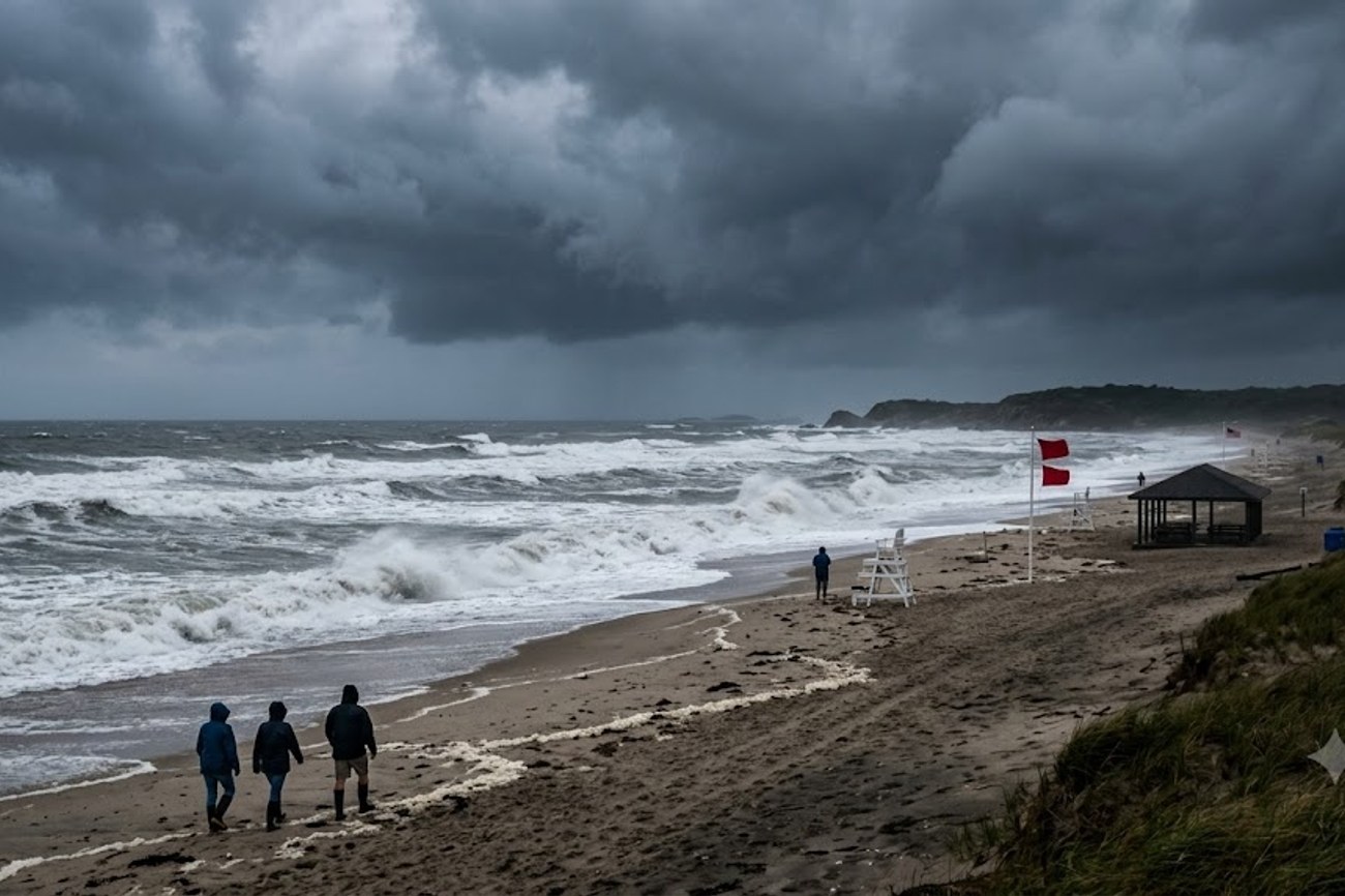
Image generated by AI
Zero margin for error exists when a September nor’easter converges with high tides and vulnerable shorelines across the US Northeast. This specific meteorological phenomenon, driven by atmospheric pressure differentials rather than tropical origins, currently threatens the coastal tourism infrastructure of Connecticut, New York, New Jersey, and Massachusetts. For the millions of seasonal visitors who frequent these Atlantic corridors, the risk is not merely a rainy weekend but a systemic disruption of beach access, marine logistics, and waterfront commerce.
The Mechanics of the Northeast Coastal Threat
Unlike the hurricanes that typically dominate September headlines, a nor’easter is a mid-latitude cyclone characterized by strong winds blowing from the northeast. These systems are born from the clash of cold continental air and warm moist air over the Atlantic, creating a pressure gradient that can push massive volumes of seawater toward the coast.
The timing of this storm is particularly volatile. By September, many coastal dunes have already been stressed by a summer of tourism and previous weather events. When a nor’easter hits, the result is often severe beach erosion and coastal flooding. For the tourism sector, this creates a cascading failure: first, the physical environment (sand and dunes) is compromised; second, the infrastructure (boardwalks and roads) is flooded; and third, the service layer (hotels and boat tours) is forced to suspend operations due to safety mandates from the National Oceanic and Atmospheric Administration (NOAA).
Regional Risk Assessment and Asset Exposure
The impact of this storm is not uniform; it varies based on the geography of the coastline and the specific assets located there. The following data outlines the primary zones of concern and the specific risks facing their tourism hubs.
| Region | Primary Tourism Hubs | Primary Risk Factors | Expected Infrastructure Impact |
|---|---|---|---|
| Connecticut | Westport, Norwalk, Bridgeport, New Haven | Long Island Sound surge, rough surf | Flooding of shoreline roads, erosion at Sherwood Island State Park |
| New York | Long Island, Atlantic Beach, Rockaway Beach | High wave energy, coastal flooding | Beach restrictions, closure of waterfront access points |
| New Jersey | Atlantic City, Ocean City, Cape May | Severe erosion, barrier island flooding | Damage to boardwalks, travel disruptions to barrier islands |
| Massachusetts | Cape Cod, Nantucket, Martha's Vineyard | Marine hazards, high wind gusts | Ferry cancellations, luxury rental access issues, dune loss |
In Connecticut, the focus remains on the Long Island Sound communities. Locations like Sherwood Island State Park Beach are particularly susceptible to flooding that can render parking and access roads impassable. In New York, the high-density tourism of Rockaway Beach and Atlantic Beach means that even minor flooding can displace thousands of visitors and disrupt local transit.
The Jersey Shore, specifically Atlantic City and Cape May, faces a dual threat of erosion and flooding. Because these areas rely heavily on the physical integrity of their beaches to attract visitors, significant sand loss during a nor’easter requires expensive and time-consuming replenishment efforts. Meanwhile, the Massachusetts coast—specifically the islands of Nantucket and Martha's Vineyard—faces a logistical crisis. These destinations are entirely dependent on marine transport; rough seas can effectively isolate these luxury markets from the mainland.
Expert Analysis: The Economic Ripple Effect of Seasonal Storms
For travelers and business owners booking these routes, the direct consequence of a September nor’easter is a sharp contraction in "last-mile" accessibility. While a flight into JFK or Newark may land safely, the journey to a coastal rental in the Hamptons or a hotel in Cape May can be severed by flooded coastal arteries.
The pricing pressure this creates is subtle but significant. When a storm disrupts a peak shoulder-season window, we often see a surge in cancellation requests and a subsequent scramble for inland alternatives. For the marine tourism sector—charters, ferries, and whale watching—the loss of three to five operational days in September can represent a significant percentage of annual quarterly revenue.
Furthermore, the reliance on the National Weather Service (NWS) for real-time updates means that travel flexibility is no longer a luxury but a requirement. The "beach erosion" mentioned in the data is not just a geological concern; it is a commercial one. When dunes vanish, the perceived value of a waterfront property or hotel drops instantly, and the cost of recovery is often passed down to the consumer through higher seasonal rates in subsequent years.
The systemic vulnerability here is the "barrier island" model of tourism. New Jersey and New York's coastal economies are built on narrow strips of land that act as the first line of defense against the Atlantic. When a nor'easter pushes water inland, these islands become bottlenecks. For the nomad or the high-end traveler, this means that "flexible planning" must include a documented exit strategy—knowing which roads remain open and which ferry lines have the highest resilience to rough surf.
Key Takeaways
- Geographic Focus: The storm primarily threatens the US Atlantic Northeast, specifically Connecticut, New York, New Jersey, and Massachusetts.
- Operational Disruptions: Expect significant cancellations in marine tourism, including ferry services to Nantucket and Martha's Vineyard.
- Infrastructure Risks: Coastal flooding and beach erosion are the primary threats, likely leading to temporary closures of parks like Sherwood Island State Park.
- Traveler Mandate: Visitors must monitor official NWS guidance and maintain flexible itineraries to avoid being stranded by flooded coastal roads.
- Economic Impact: Late-season storms threaten the revenue of waterfront businesses and may lead to increased recovery costs for beach municipalities.
FAQ: Northeast Coastal Storms 2024
How do I know if my beach hotel will be closed during a nor'easter? Check the official municipal website or the Federal Emergency Management Agency (FEMA) for evacuation or closure notices. Most hotels will communicate via email, but local government alerts are the definitive source for beach restrictions.
Will ferry services to Martha's Vineyard and Nantucket still run? Ferry operations depend entirely on wave height and wind speed. During a nor'easter, rough seas often lead to cancellations. Always confirm your departure status with the ferry operator 24 hours in advance.
Is a nor'easter the same as a hurricane? No. While both bring wind and rain, hurricanes are tropical systems fueled by warm ocean water. Nor'easters are extratropical cyclones caused by temperature contrasts between land and sea, typically occurring in cooler months.
What should I do if I am driving along the New Jersey Shore during the storm? Avoid barrier islands and low-lying coastal roads. Monitor real-time traffic and flood warnings via state transportation departments to avoid being trapped by coastal flooding.
When the Atlantic pushes back, the only winning strategy for the traveler is total flexibility.
#NortheastNorEaster2024 #JerseyShoreTourism #CapeCodTravel #CoastalFloodingUS #AtlanticCoastWeather #NewYorkBeachSafety
Related Travel Guides
- Flights Cancelled Around Europe as Edinburgh, London, and 17 Other Airports Cancel 204 and Delay 2,209, Disrupting Air Travel Throughout The Continent
- Wizz Air Launches Four-Weekly Year-Round Sofia to Berlin Flights with Fares Starting at €31.99
- SCAT Airlines Launches Twice-Weekly Singapore to Shymkent Service via Sanya Utilizing Boeing 737 MAX 8 Aircraft
Disclaimer
This article is for informational and educational purposes only. It does not constitute legal, financial, or professional advice. While we strive to provide accurate and up-to-date information, travel policies, regulations, and conditions change rapidly. Always verify information with official sources before making travel decisions. Nomad Lawyer makes no representations about the accuracy, reliability, completeness, or suitability of the information provided. Readers should consult qualified professionals for advice specific to their circumstances. The views expressed in this article are those of the author and do not necessarily reflect the views of Nomad Lawyer.
Preeti Gunjan
Contributor & Community Manager
A passionate traveller and community builder. Preeti helps grow the Nomad Lawyer community, fostering engagement and bringing the reader experience to life.
Learn more about our team →