
Sri Lanka Travel Alert as Powerful Landslide Cuts Off Hatton Bogawantalawa Route and Disrupts Hill Country Journeys
Sri Lanka Travel Alert as Powerful Landslide Cuts Off Hatton Bogawantalawa Route and Disrupts Hill Country Journeys

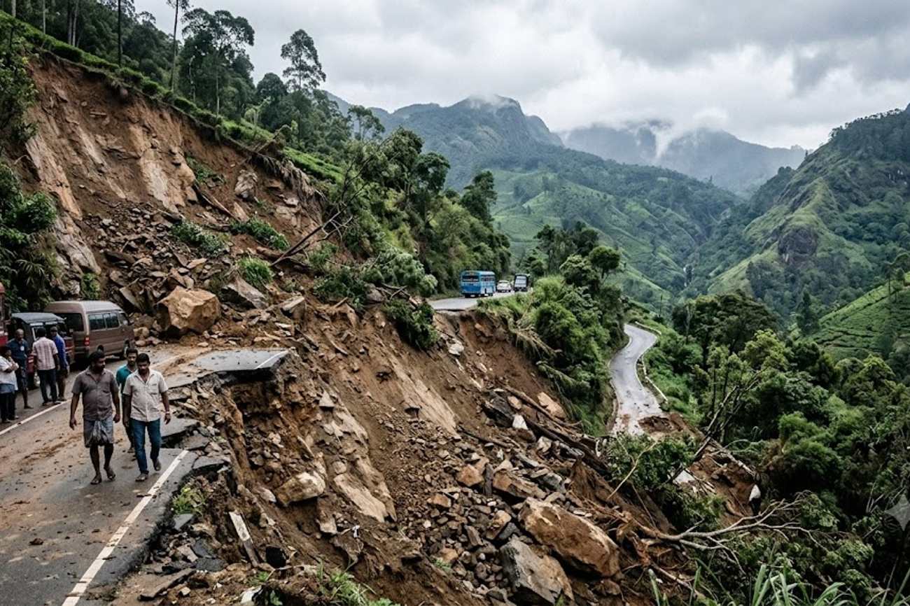
Image generated by AI
One primary transit artery connecting Hatton, Bogawantalawa, Maskeliya, and Balangoda was completely severed at 11:00 a.m. on 20 September 2026, following a massive landslide triggered by intense rainfall. This geological failure occurred specifically near the Wanaraja Estate in Dickoya, situated within the Nuwara Eliya District of the Central Province, effectively paralyzing traffic movement across a critical segment of the Sri Lankan hill country.
The Anatomy of a Highlands Transit Failure
The incident is not an isolated weather event but a systemic failure of slope stability in one of the world's most precarious tourism corridors. The Hatton–Bogawantalawa–Maskeliya–Balangoda route serves as a logistical lifeline for the Central Highlands, facilitating the movement of both commercial tea exports and international tourists. When heavy precipitation saturates the volcanic and metamorphic soils of the Nuwara Eliya region, the resulting pore-water pressure often exceeds the shear strength of the slope, leading to the rapid debris flows witnessed at Wanaraja Estate.
For the traveler, Hatton is more than a transit point; it is the primary gateway to the high-altitude attractions of the interior. The blockage of this specific road disrupts the flow of traffic toward Adam’s Peak and the various tea estates that define the region's economic and touristic identity. While the Sri Lanka Tourism Development Authority promotes the aesthetic appeal of these emerald mountains, the physical reality is a network of narrow, winding roads carved into unstable terrain.
Logistical Disruption and Data Breakdown
The scale of the blockage necessitated an immediate mobilization of the Hatton Police and local civilian volunteers. However, the volume of earth and debris was sufficient to require heavy machinery from the Road Development Authority to achieve full clearance.
The following table outlines the specific geographical and temporal parameters of the disruption:
| Parameter | Detail |
|---|---|
| Date of Occurrence | 20 September 2026 |
| Time of Impact | 11:00 a.m. |
| Primary Location | Wanaraja Estate, Dickoya |
| Administrative District | Nuwara Eliya, Central Province |
| Affected Route | Hatton–Bogawantalawa–Maskeliya–Balangoda |
| Primary Cause | Heavy rainfall inducing slope instability |
| Casualty Report | Zero confirmed tourist injuries |
The operational challenge for the Road Development Authority is twofold: the immediate removal of debris and the long-term stabilization of the slope. Because the soil remains saturated, the risk of secondary "after-slips" remains high, meaning that even as the road is cleared, the window of safe passage remains narrow and volatile.
Expert Analysis: The High-Altitude Logistics Trap
From a senior editorial perspective, this landslide reveals a recurring vulnerability in Sri Lanka’s tourism infrastructure: the "single-point-of-failure" risk. Many of the most scenic routes in the Central Highlands lack viable, paved alternatives. When a primary road like the Hatton–Bogawantalawa route is blocked, there is rarely a secondary highway of equal capacity to absorb the diverted traffic.
For travelers booking journeys through the hill country, the direct consequence is a "logistics trap." A delay in Dickoya does not merely add an hour to a trip; it can trigger a cascade of missed hotel check-ins in Nuwara Eliya or missed train connections in Hatton. The pricing pressure this creates is often felt in the "last-mile" transport sector. When main roads close, private drivers may demand higher premiums to navigate longer, more arduous detour routes, or tour operators may be forced to cancel high-value excursions to Adam's Peak.
Furthermore, this event underscores the tension between the World Meteorological Organization (WMO) warnings regarding intensifying rainfall patterns and the static nature of mountain road engineering. The reliance on manual clearance by police and residents, followed by a request for machinery, suggests a reactive rather than proactive disaster management strategy. For the nomadic traveler or the high-end tourist, the lesson is clear: itineraries in the Central Province during the rainy season must include a 20% to 30% "time buffer" to account for these inevitable geological disruptions.
Key Takeaways
- Route Paralysis: The critical link between Hatton and Balangoda via Bogawantalawa was fully blocked as of 11:00 a.m. on 20 September 2026.
- Zero Casualties: No tourist injuries have been reported, confirming the event as a logistical crisis rather than a humanitarian one.
- High Secondary Risk: Authorities warn that continued saturation of the mountain terrain makes additional landslides likely during clearance operations.
- Gateway Impact: Travel to Adam’s Peak and Nuwara Eliya is subject to significant delays due to the central role of Hatton as a transit hub.
- Infrastructure Vulnerability: The event highlights the lack of redundant road networks in the Nuwara Eliya District.
FAQ: Sri Lanka Hill Country Travel 2026
Is it safe to travel to Nuwara Eliya during the rainy season? Yes, but it requires extreme caution. Travelers should avoid non-essential mountain roads during heavy downpours and rely on professional drivers who are familiar with current landslide alerts and official detours provided by local police.
What should I do if my tour route is blocked by a landslide? Immediately contact your tour operator to identify official detours. Avoid attempting to bypass blockages via unpaved estate roads, as these are often more unstable than the main highways during periods of heavy rain.
How can I get real-time road updates in the Central Province? Monitor local police announcements in Hatton and Dickoya. It is also advisable to check with the Road Development Authority or your hotel concierge, as they receive the most current updates on machinery deployment and road openings.
Will this landslide affect flights or train travel in the region? The landslide affects road transit. While trains to Nuwara Eliya/Hatton generally operate on separate tracks, road transfers from the station to your final destination may be delayed if the affected routes are part of your transfer.
The beauty of the highlands is matched only by the volatility of its terrain; plan for the slide, not just the scenery.
Tags: Hatton-Bogawantalawa-Route, Nuwara-Eliya-Landslide-2026, Central-Province-Sri-Lanka, Wanaraja-Estate-Dickoya, Sri-Lanka-Road-Development-Authority
Related Travel Guides
- UAE And Qatar Endure a Devastating Middle East Travel Warning Dragging Iraq and Other Countries into Disruptions Amid US Alerts
- Wisconsin Moves With Michigan as US Flooding Forecast Raises Flash-Flood Risks Across Key Travel Regions
- Why the New 2026 Dining Laws of Abu Dhabi Will Transform Your Next Vacation
Disclaimer
This article is for informational and educational purposes only. It does not constitute legal, financial, or professional advice. While we strive to provide accurate and up-to-date information, travel policies, regulations, and conditions change rapidly. Always verify information with official sources before making travel decisions. Nomad Lawyer makes no representations about the accuracy, reliability, completeness, or suitability of the information provided. Readers should consult qualified professionals for advice specific to their circumstances. The views expressed in this article are those of the author and do not necessarily reflect the views of Nomad Lawyer.
Kunal K Choudhary
Co-Founder & Contributor
A passionate traveller and tech enthusiast. Kunal contributes to the vision and growth of Nomad Lawyer, bringing fresh perspectives and driving the community forward.
Learn more about our team →