
Iceland Restricts Sólheimajökull Glacier Excursions in 2026 Following IMO Safety Warnings on Ice Thinning
The Icelandic Meteorological Office has issued safety warnings for Sólheimajökull Glacier, leading to the suspension of guided walks on specific routes due to thinning ice barriers and rockfall risks.
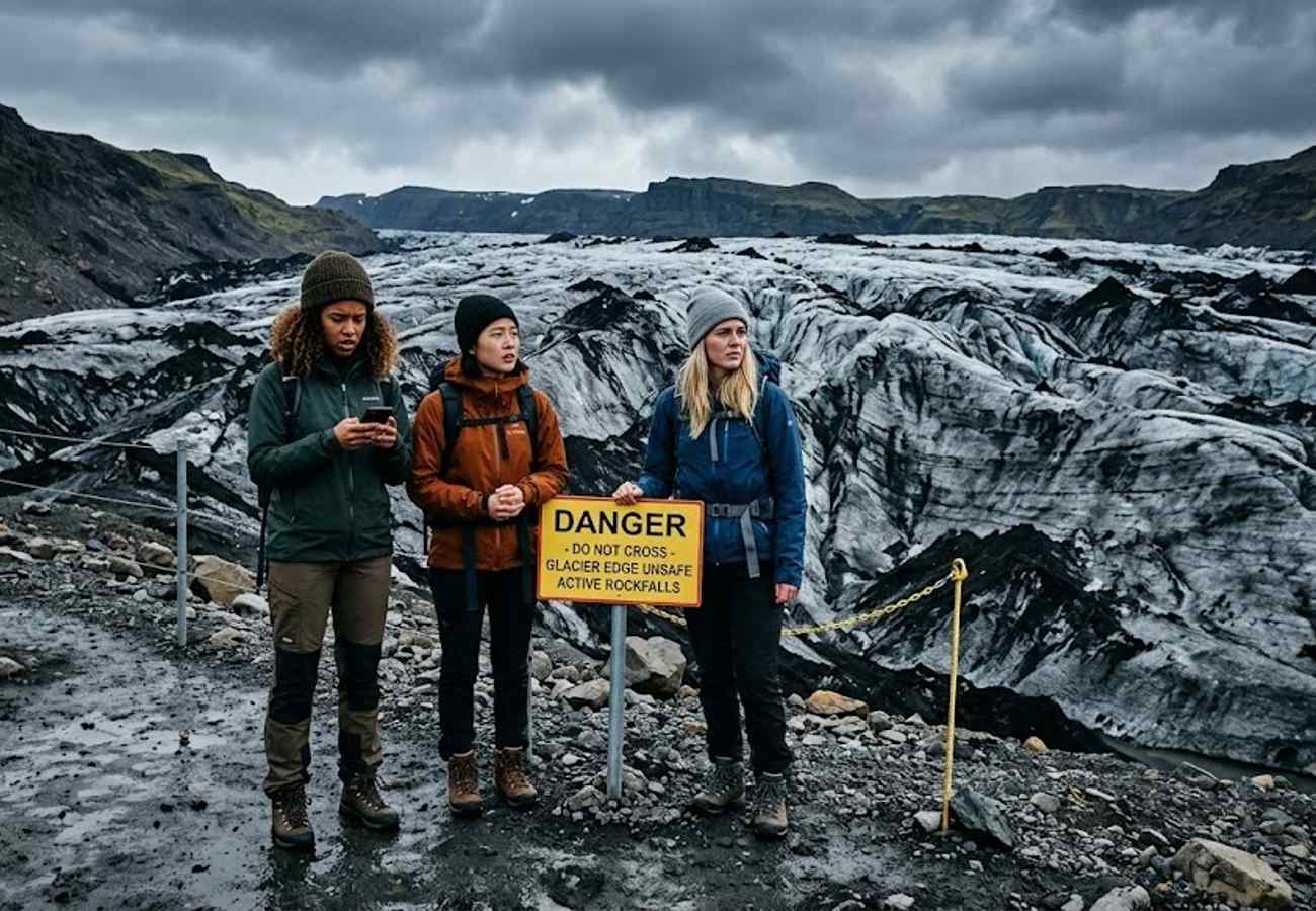
Image generated by AI
Headline Options:
- Factual: Icelandic Meteorological Office Issues Safety Warnings Leading to Restricted Glacier Excursions at Sólheimajökull in South Iceland
- Curiosity-Gap: The Changing Face of Iceland: Why One of the World's Most Famous Glaciers is Now Restricted
- Problem-Solving: How to Navigate Sólheimajökull Glacier Restrictions and Plan a Safe South Iceland Itinerary
The Icelandic Meteorological Office (IMO) has triggered immediate safety restrictions at Sólheimajökull Glacier, suspending specific guided routes due to unstable ice barriers and high rockfall risks.
The Core Transit Update: Sólheimajökull Access Restrictions
The Icelandic Meteorological Office (IMO) has issued a formal advisory regarding the rapidly evolving conditions at Sólheimajökull, an outlet glacier of the Mýrdalsjökull Ice Cap. These warnings center on two primary geological hazards: the thinning of ice barriers surrounding newly formed glacial lagoons and an increased frequency of rockfalls along the southeastern approach.
In direct response, licensed tour operators have suspended guided glacier walks on the affected sections. These measures are precautionary, allowing experts to monitor ice stability and erosion caused by rising temperatures. While the glacier remains open to visitors in designated safe zones, the suspension of specific routes highlights the volatility of the South Coast's glacial landscapes.
Sólheimajökull Route & Regional Specifications
The following data outlines the logistics and proximity of the affected site relative to major transit hubs in South Iceland.
| Parameter | Detail |
|---|---|
| Glacier Type | Outlet glacier of Mýrdalsjökull Ice Cap |
| Primary Hazards | Thinning ice barriers, glacial lagoon instability, southeastern rockfalls |
| Distance from Reykjavík | Approximately 160 km (2.5 to 3 hours driving) |
| Nearest Town (Primary) | Vík í Mýrdal (~34 km) |
| Nearest Town (Secondary) | Skógar (~12 km) |
| Closest Airport | Keflavík International Airport (~190 km) |
| Authorized Access | Licensed guided tours only (restricted routes) |
Traveler Logistics Guide: Navigating South Iceland Safety
From a ground-level perspective, the best way to navigate these restrictions is to abandon "DIY" glacier exploration. Glaciers are dynamic environments where a path that was safe 24 hours ago may now be a hidden crevasse or an unstable ice bridge.
Booking and Connection Strategies When booking South Coast excursions, ensure your operator is licensed and maintains a real-time communication link with the IMO. If your primary glacier hike is cancelled, do not attempt to find an "unmarked" path. Instead, utilize the flexibility of your itinerary to pivot to the region's other high-density attractions.
Optimal Layover and Transit Tips
- Buffer Time: Allow an extra 60-90 minutes in your schedule for "safety briefings" and route adjustments. Operators may need to divert you to a different part of the glacier, which can extend the walking time.
- Digital Guidance: Monitor official Icelandic weather and safety portals (such as SafeTravel.is) before departing Reykjavík.
- Equipment: Even in restricted zones, crampons and ice axes are mandatory for any ice contact. Ensure these are provided by the operator rather than relying on low-grade rental gear.
Infrastructure Impact Assessment
The restrictions at Sólheimajökull are a microcosm of the broader environmental shift across Iceland. As the Mýrdalsjökull Ice Cap retreats, the resulting landscape becomes more hazardous for traditional tourism. This necessitates a shift in infrastructure—moving away from fixed "tourist paths" toward a dynamic, guide-led model where routes are determined daily based on meteorological data.
Despite the localized restrictions, the regional connectivity of South Iceland remains robust. The impact on overall tourism is minimal, as the region's appeal is diversified across waterfalls, black sand beaches, and volcanic fields, ensuring that the "South Coast loop" remains viable for international travelers.
Regional Alternatives for Itinerary Planning
For those unable to access specific Sólheimajökull routes, the following sites provide similar geological interest with different risk profiles:
- Skógafoss and Seljalandsfoss: High-volume waterfalls with stable viewing platforms.
- Reynisfjara Black Sand Beach: Coastal basalt formations (note: beware of "sneaker waves").
- Þórsmörk: A nature reserve offering rugged hiking and valley views.
- Dyrhólaey: A promontory offering panoramic views of the coastline.
Safety in Iceland is not a static guarantee, but a continuous negotiation with the elements.
Related Travel Guides
Disclaimer
This article is for informational and educational purposes only. It does not constitute legal, financial, or professional advice. While we strive to provide accurate and up-to-date information, travel policies, regulations, and conditions change rapidly. Always verify information with official sources before making travel decisions. Nomad Lawyer makes no representations about the accuracy, reliability, completeness, or suitability of the information provided. Readers should consult qualified professionals for advice specific to their circumstances. The views expressed in this article are those of the author and do not necessarily reflect the views of Nomad Lawyer.

Kunal K Choudhary
Co-Founder & Contributor
A passionate traveller and tech enthusiast. Kunal contributes to the vision and growth of Nomad Lawyer, bringing fresh perspectives and driving the community forward.
Learn more about our team →