
Vermilion River Reservation Guide 2026: Ancient Shale Cliffs, Bald Eagles, and Pioneer Heritage in Ohio
Explore northern Ohio's hidden geological river canyon, featuring ancient Devonian shale walls, daily bald eagle sightings, pioneer history, and 27 miles of paddling trails.

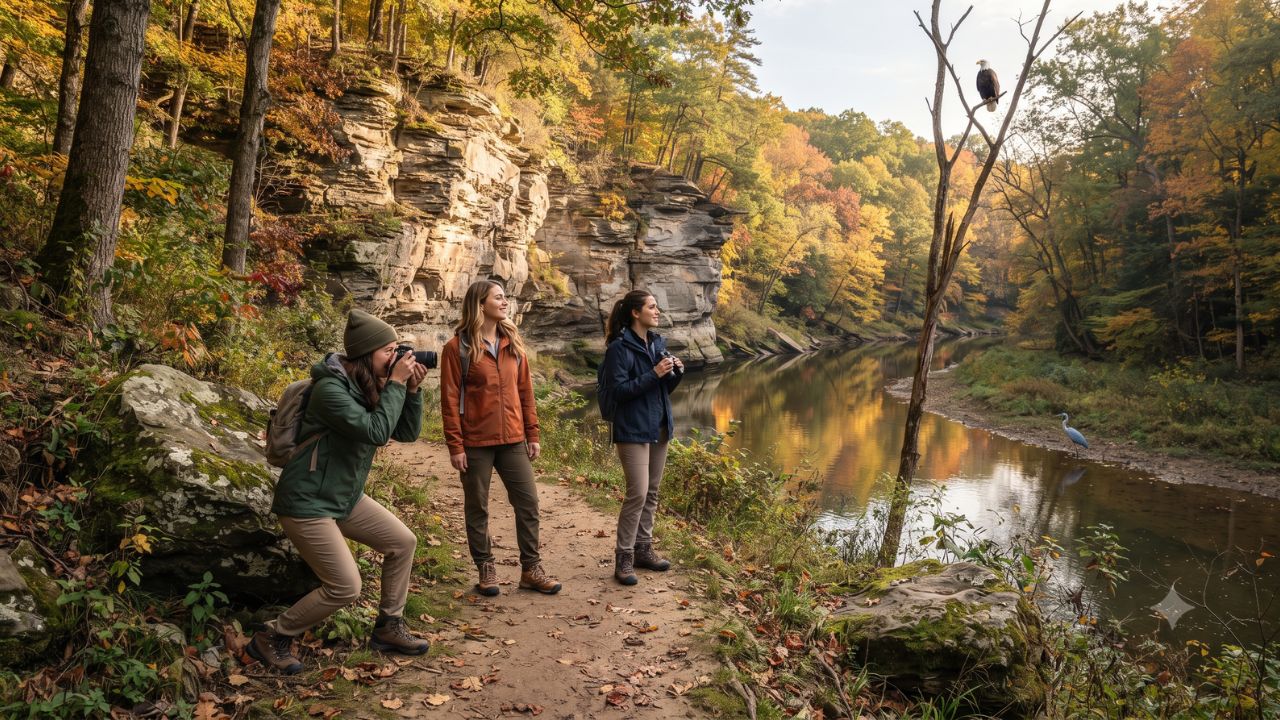
Perched high in the towering sycamores above Mill Hollow, wild bald eagles are observed almost daily hunting along the carved gorges of the Vermilion River, where dramatic Devonian shale walls and rare turtle rock formations line the riverbed. Situated just five miles south of Lake Erie in the town of Vermilion, the Vermilion River Reservation provides a diverse natural retreat that challenges standard perceptions of Midwestern topography. Across two distinct sectors—Mill Hollow and Bacon Woods—the park integrates over three miles of scenic hiking trails, an 1817 pioneer farmstead, dedicated kayak launch points, and active naturalist programming within a protected river corridor.
The Geological and Outdoor Appeal of Mill Hollow and Bacon Woods
Unlike the flat agricultural plains common across northern Ohio, the Vermilion River has spent millions of years slicing through deep bedrock, creating towering vertical shale cliffs that expose distinct geological strata. Visitors walking along the riverbed discover a mosaic of weathered sandstone, dark carbonaceous shale, and distinctive "turtle rock" concretions formed by ancient mineral deposits.
Administered by the Lorain County Metro Parks system—which protects over 9,000 acres and maintains more than 110 miles of trails across the county—the Vermilion River Reservation stands as the foundational property of the entire district. The reservation's dual-sector layout spans both banks of the river: Mill Hollow on the eastern shore houses the park's primary recreation fields, picnic pavilions, and Visitor Center, while Bacon Woods on the western bluff preserves mature hardwood forests and regional pioneer history.
For adventure paddlers, the park serves as the primary southern launch point for the 27-mile Vermilion-Lorain Water Trail. The water route begins below the shale cliffs at the reservation, winding north toward Lake Erie before tracing coastal channels eastward toward the Black River Reservation in Elyria.
What Makes the Vermilion River Gorge Geologically Unique
The primary draw for naturalists and photographers visiting the reservation is the immediate visibility of ancient sedimentation layers. The steep canyon walls rise directly from the water's edge, creating a sheltered microclimate that supports rich riparian biodiversity.
According to biological surveys conducted by the Ohio Department of Natural Resources, the Vermilion River sustains exceptionally high aquatic water quality. The clean, gravelly riffles support native freshwater clams and several sensitive darter species, while the presence of pollution-sensitive macroinvertebrates—including mayflies, caddisflies, and water pennies—signals a thriving riverine ecosystem. This dense food web supports diverse avian populations; beyond resident bald eagles, birdwatchers regularly document great blue herons, green-backed herons, migratory waterfowl, and kingfishers along the forest edges.
Human heritage is preserved alongside natural history. In 1817, pioneer settler Benjamin Bacon cleared land along the oxbow bend above the river, establishing family operations in timber milling, farming, and local sandstone quarrying. Today, the restored Bacon House operates as an authentic 19th-century house museum, allowing visitors to examine frontier domestic life and learn how early settlers harnessed waterpower from the rushing river currents.
Visitor Profile & Facility Directory: Vermilion River Reservation
The table below outlines key operational details, visitor facilities, trail configurations, and recreational offerings available at the reservation:
| Feature / Facility | Location within Park | Operational Details & Specifications | Key Activities & Highlights |
|---|---|---|---|
| Park Grounds | 51211 North Ridge Rd, Vermilion | Open daily from 8:00 AM to sunset | Walking, wildlife viewing, picnicking, photography |
| Visitor Center | Mill Hollow Sector | Open daily 10:00 AM to 4:30 PM | Interpretive exhibits, trail maps, walking center |
| Shale River Cliffs | Mill Hollow Riverbed | Natural Devonian rock formations | Geological observation, photography, turtle rock hunting |
| Benjamin Bacon House | Bacon Woods Sector | Restored 1817 pioneer residence | Historical house museum tours, pioneer artifacts |
| Hiking Trail System | Throughout both sectors | 3+ miles (asphalt, crushed stone, dirt) | Accessible nature walks, forest hiking, birding |
| Paddling Launch | Designated riverbank ramp | Southern terminus of 27-mile water trail | Kayak and canoe touring toward Lake Erie |
| Disc Golf Course | Open meadow sector | Multi-hole recreational course | Casual outdoor sport in scenic parkland setting |
| Naturalist Programs | Visitor Center & Trailheads | Year-round seasonal calendar | Free guided Nature Hikes, geology & wildlife talks |
Visitor Insider Tips
Planning an excursion to the Vermilion River requires understanding seasonal water flows and trail conditions:
- Bring Water Shoes for Riverbed Exploration: During summer and early autumn when water levels drop, the best perspective of the towering shale cliffs is from the shallow riverbed itself. Wear sturdy, slip-resistant water shoes to navigate slippery shale ledges and discover rounded turtle rock formations.
- Locate the Bald Eagle Roost: Look for bald eagles during the early morning hours near the tall sycamore and cottonwood groves directly across from the Mill Hollow picnic lawns. Bring a telephoto camera lens or binoculars, as birds frequently perch near the tree canopy overlooking the central oxbow bend.
- Join Seasonal Naturalist Walks: Take advantage of the free educational events organized by Lorain County Metro Parks. During October 2026, staff naturalists lead specialized woodland hikes examining the biological science behind autumn leaf pigments, while annual youth programs like the Vermilion River Ramblers Camp introduce children aged seven to nine to stream ecology.
- Combine with Lake Erie Coastal Stops: The reservation sits less than ten minutes from historic downtown Vermilion's Harbour Town district. Pair a morning hike with an afternoon visit to Lake Erie beaches and coastal maritime museums promoted by TourismOhio.
Cultural and Environmental Context
The preservation of the Vermilion River corridor represents a landmark achievement in Ohio conservation history. When the Bacon family donated their ancestral farmstead to establish Lorain County's first public park, they prevented industrial quarrying and residential subdivision from destroying the fragile river oxbow.
Maintaining the ecological health of the Vermilion River is vital for the broader Lake Erie watershed. Because the river flows directly into the western basin of Lake Erie, protecting riparian buffer zones along the reservation prevents agricultural runoff, curbs soil erosion along unstable shale embankments, and safeguards spawning habitats for native freshwater fish. Visitors are encouraged to practice strict Leave No Trace principles, stay on designated bluestone and dirt paths, and avoid climbing fragile shale cliff faces to prevent rock decay.
FAQ: Visiting Vermilion River Reservation 2026
What are the daily operating hours for Vermilion River Reservation?
The park grounds are open daily from 8:00 AM until sunset. The on-site Visitor Center operates daily from 10:00 AM to 4:30 PM.
Can visitors launch kayaks and canoes at the reservation?
Yes. The park features a dedicated public launch ramp connecting paddlers to the 27-mile Vermilion-Lorain Water Trail winding toward Lake Erie.
Is there an admission fee to enter the park or tour the Bacon House?
No. General admission to the Vermilion River Reservation grounds, trails, Visitor Center, and naturalist-led Nature Hikes is completely free.
How long is the hiking trail network at the reservation?
The park features over three miles of interconnected trails offering a mix of paved asphalt, crushed limestone, and natural forest dirt surfaces.
Standing at the base of Vermilion’s ancient shale amphitheater while eagles circle overhead proves that Ohio’s quiet river valleys hold wilderness wonders that rival any mountain gorge.
Related Travel Guides
Disclaimer
This article is for informational and educational purposes only. It does not constitute legal, financial, or professional advice. While we strive to provide accurate and up-to-date information, travel policies, regulations, and conditions change rapidly. Always verify information with official sources before making travel decisions. Nomad Lawyer makes no representations about the accuracy, reliability, completeness, or suitability of the information provided. Readers should consult qualified professionals for advice specific to their circumstances. The views expressed in this article are those of the author and do not necessarily reflect the views of Nomad Lawyer.
Raushan Kumar
Founder & Lead Developer
Full-stack developer with 11+ years of experience and a passionate traveller. Raushan built Nomad Lawyer from the ground up with a vision to create the best travel and law experience on the web.
Learn more about our team →