
Ntsizwa Mountain Hiking Trail: Discovering Umzimvubu's Indigenous Wilderness and Lugelweni Falls in 2026

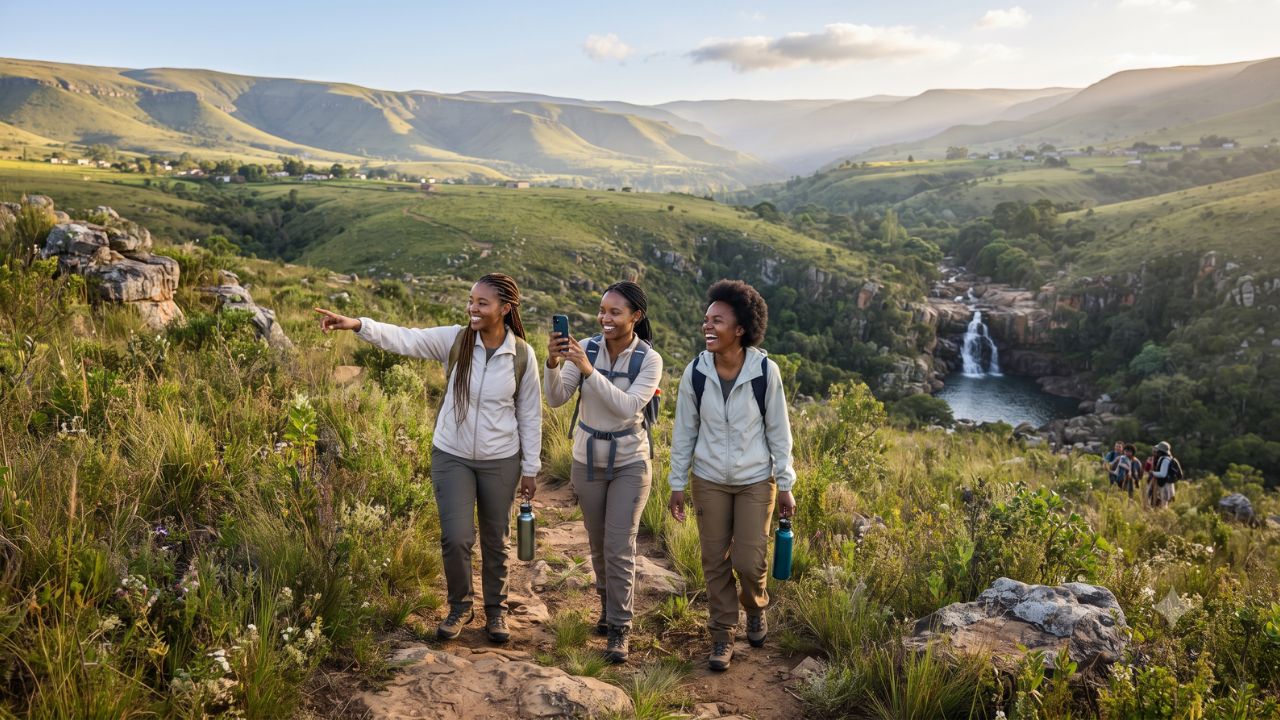
Winding across the rugged granite peaks of the Alfred Nzo District where wild mountain proteas and endemic bird species thrive undisturbed by commercial tourism, the Ntsizwa Mountain Hiking Trail links remote traditional villages across the roof of the Eastern Cape. This newly highlighted community trekking route connects Lusuthu Village with Lugelweni Village, leading hikers across high-altitude grasslands and indigenous montane forests before terminating at the thundering cascades of Lugelweni Waterfalls.
Situated within the Umzimvubu Local Municipality, the Ntsizwa mountain range represents a pristine ecological frontier in South Africa. While international travelers routinely flock to the Garden Route or the beaches of the Wild Coast, the high interior mountains around Mount Frere (KwaBhaca) and Mount Ayliff (eMaxesibeni) offer an authentic rural sanctuary. Here, ancient Xhosa cultural customs, communal cattle grazing traditions, and high-elevation biodiversity exist in harmonious balance.
Community Eco-Tourism Unlocks the High Valleys of Umzimvubu
The formalization of the Ntsizwa Mountain trail network reflects a broader shift toward community-led conservation and decentralized tourism development across South Africa. Rather than confining visitor spending to private game reserves, the Umzimvubu municipality has partnered with traditional village leadership to establish a self-sustaining eco-trail that generates direct economic opportunities for rural households.
Local youths from Lusuthu and Lugelweni have undergone training as certified interpretive field guides, sharing ancestral oral histories, medicinal plant knowledge, and geological insights with visiting trekking groups. Guesthouse accommodation, pack transport, and home-cooked traditional meals provide sustainable income streams that incentivize the protection of indigenous forest patches and river catchment basins.
According to regional ecotourism directives established by the Eastern Cape Parks and Tourism Agency, developing community hiking corridors strengthens ecological corridors between the Drakensberg escarpment and coastal nature reserves, creating sustainable alternatives to intensive mining or overgrazing.
What Makes Ntsizwa Mountain and Lugelweni Falls Distinct
The physical terrain of Ntsizwa Mountain provides an extraordinary diversity of microclimates and botanical habitats:
Beginning at Lusuthu Village, the trail ascends through rolling highland sourveld grasslands dotted with red-hot pokers (Kniphofia) and alpine aloes. The high ridges provide sweeping panoramic vistas stretching across the Mzimvubu River basin toward the southern Drakensberg mountains.
As the path descends toward sheltered valley ravines, hikers enter ancient Afromontane forest pockets sheltering yellowwood trees, wild olive groves, and endemic cycads. These sheltered canopies serve as vital nesting sanctuaries for rare avian species, including the Cape parrot, southern ground hornbill, Narina trogon, and crowned eagle, monitored under conservation research by the South African National Biodiversity Institute.
The natural climax of the trek is Lugelweni Waterfalls, where mountain river waters plunge down a tiered amphitheater of dark dolerite cliffs into deep, crystal-clear rock pools. The shaded plunge pools offer refreshing wild swimming spots surrounded by moss-covered river boulders and maidenhair ferns, providing an idyllic conclusion to a demanding day of mountain walking.
Official national travel initiatives from South African Tourism emphasize that off-the-beaten-path trails like Ntsizwa allow adventure travelers to experience the genuine warmth of rural African hospitality in an untouched natural environment.
Visitor Insider Tips
Trekking through rural Eastern Cape mountains requires preparation, cultural awareness, and respect for village protocols:
- Hire a Local Village Guide: Never attempt the Ntsizwa trail independently. The mountain paths cross unmarked grazing trails, and hiring a local guide from Lusuthu Village ensures safe navigation while directly supporting the host community.
- Village Etiquette and Greetings: When entering Lusuthu or Lugelweni, greet village elders and residents with respectful courtesy (Molo for one person, Molweni for a group in isiXhosa). Always ask for permission before photographing village homesteads or livestock enclosures.
- Seasonal Weather Awareness: Mountain weather can change abruptly. While summer (November to February) brings lush green scenery, afternoon thunderstorms are common. Start hikes at dawn around 6:00 AM to reach Lugelweni Waterfalls before mid-afternoon rain clouds gather.
- Sample Traditional Xhosa Cuisine: Enjoy authentic home-cooked meals prepared in the villages, including umngqusho (slow-cooked samp and sugar beans seasoned with butter and herbs) and freshly baked umbhako (steamed pot bread).
- Transport and Road Access: Accessing Lusuthu Village requires a high-clearance vehicle or 4x4, particularly along gravel access roads connecting from the N2 highway between Kokstad and Mthatha.
Cultural and Environmental Context
The grasslands and montane forests of the Umzimvubu basin form an essential watershed that feeds the great Mzimvubu River, one of the last major free-flowing, undammed river systems in Southern Africa. Preserving the health of this catchment area is vital for soil conservation, downstream farming communities, and estuarine marine life along the Indian Ocean coast.
Community-managed eco-tourism encourages local grazing associations to practice rotational pasture management, preventing severe soil erosion and invasive wattle tree encroachment along mountain slopes. By recognizing the economic and ecological value of their pristine mountain ecosystems, the communities of Lusuthu and Lugelweni demonstrate how grassroots tourism stewardship can safeguard indigenous biodiversity while empowering rural African youth.
FAQ: Visiting Ntsizwa Mountain and Umzimvubu 2026
Where is the Ntsizwa Mountain Hiking Trail located?
The trail is situated in the Umzimvubu Local Municipality in South Africa's Eastern Cape province, connecting Lusuthu and Lugelweni villages near Mount Frere.
How long is the hiking route between Lusuthu and Lugelweni?
The standard trekking route spans approximately 12 to 14 kilometers, taking between 4 to 6 hours depending on hiking pace and time spent at Lugelweni Waterfalls.
What level of fitness is required for the Ntsizwa trail?
The trail features moderate to strenuous ascents along rocky mountain paths, requiring a reasonable level of physical fitness and sturdy, ankle-supporting hiking boots.
When is the best time of year to hike Ntsizwa Mountain?
Autumn (March to May) and spring (September to October) offer clear blue skies, comfortable daytime hiking temperatures, and stable weather patterns.
Across the quiet ridges of Ntsizwa, the rhythm of mountain streams and ancestral village trails reminds travelers that South Africa's truest wilderness is shared with the people who call it home.
Related Travel Guides
Disclaimer
This article is for informational and educational purposes only. It does not constitute legal, financial, or professional advice. While we strive to provide accurate and up-to-date information, travel policies, regulations, and conditions change rapidly. Always verify information with official sources before making travel decisions. Nomad Lawyer makes no representations about the accuracy, reliability, completeness, or suitability of the information provided. Readers should consult qualified professionals for advice specific to their circumstances. The views expressed in this article are those of the author and do not necessarily reflect the views of Nomad Lawyer.
Raushan Kumar
Founder & Lead Developer
Full-stack developer with 11+ years of experience and a passionate traveller. Raushan built Nomad Lawyer from the ground up with a vision to create the best travel and law experience on the web.
Learn more about our team →