
Travel Advisories: Hawk Fire Reno Surges Past 10,500 Acres
The Hawk Fire near Reno, Nevada, surges past 10,500 acres, triggering evacuation orders, power cuts, and closing sections of US 395.

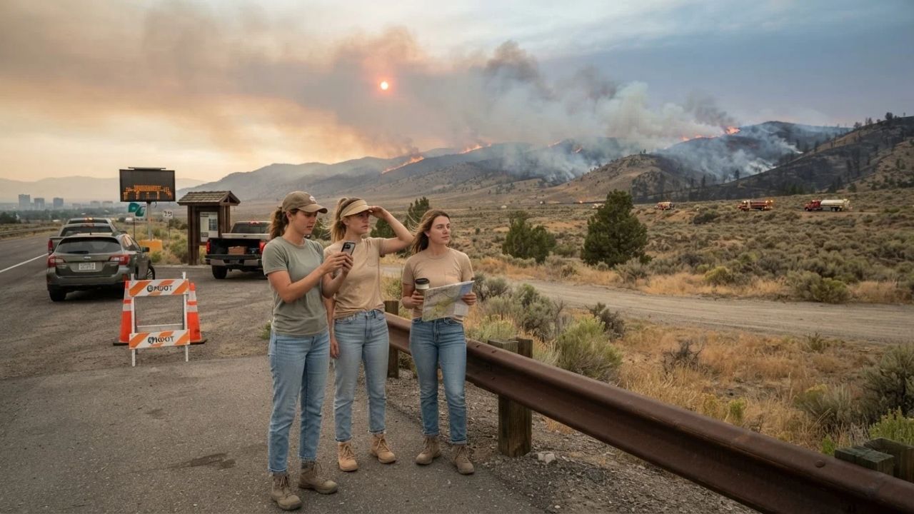
Image generated by AI
The Hawk Fire near Reno, Nevada, surges past 10,500 acres, triggering evacuation orders, power cuts, and closing sections of US 395. The National Weather Service indicates that wind gusts of up to 40 mph and humidity levels as low as 12 percent create volatile fire weather across Washoe County.
The Relationship Between Wildfires and Western Transit Corridors
A critical challenge in western United States travel planning is the exposure of major highway and energy grids to seasonal wildfire behavior. Historically, emergency management systems analyzed fires primarily through rural land damage and forestry impacts, treating road closures and flight status updates as secondary concerns. In 2026, transit agencies must address these challenges as direct threats to regional connectivity. Wildfires quickly cross high-speed corridors, forcing immediate highway shutdowns and halting regional cargo networks.
When major routes (like US 395) close, detour congestion spreads to local roads. This disruption shows why real-time monitoring and proactive power shutoffs are vital components of modern passenger safety.
Hawk Fire Status and Weather Indicators
The wildfire developed rapidly on the hillsides north of Reno:
- Fire Acreage: Surged past over 10,500 acres (10,500+ acres) on August 22, 2026.
- Threatened Structures: Approximately 1,000 homes placed under evacuation orders.
- Wind Speed & Direction: Moving northeast under winds of 15 to 25 mph, with gusts reaching up to 40 mph.
- Relative Humidity: Dropped to as low as 12 percent (12%), creating dry fuel conditions.
- Evacuation Warnings: Extended across the California-Nevada border into Sierra County.
These conditions force crews to focus on protecting residential perimeters while roads and utility grids remain restricted.
Infrastructure Closures and Power Outages
The emergency has affected local transit and electricity grids:
- Highway Shutdown: US 395 closed between Parr Boulevard and Red Rock Road, blocking a key route linking Reno to California.
- Power Shutoffs: Utility companies de-energized lines to reduce fire risks, affecting around 37,000 customers across Truckee and North Lake Tahoe.
- Truckee Donner Public Utility District: Affected nearly 15,000 customers.
- Liberty Utilities: Left approximately 22,000 customers without electricity.
- Visitor Impact: Outages affect hotel services, online booking platforms, and neighborhood food refrigeration.
These closures make it necessary for travelers to confirm accommodation status before arriving in northern Washoe County.
Reno-Tahoe International Airport Operations
Despite the nearby fire, the regional air gateway serves as an alternative travel route:
- Daily Flight Volume: Reno-Tahoe International Airport (RNO) manages more than 130 daily arrivals and departures.
- Airline & Route Capacity: Serves more than 20 nonstop destinations via 10 airlines.
- Core Routes: Connections include Atlanta, Chicago, Dallas, Denver, Los Angeles, New York, Phoenix, San Francisco, and Seattle.
- International Flights: Features Volaris connections to Guadalajara.
While flights continue, passengers must check visibility conditions and road access routes before heading to the terminal.
Northern Nevada Wildfire Comparison
The table below compares the Hawk Fire with recent and historic fire incidents in Washoe County recorded on August 23, 2026:
| Fire Name & Year | Fire Size (Acreage) | Core Travel & Infrastructure Impact | Primary Emergency Agency |
|---|---|---|---|
| Hawk Fire (2026) | Over 10,500 acres | US 395 closure, 37,000 power cuts | Truckee Meadows Fire Chief |
| Bug & Fred Mountain (2026) | 16,000+ acres combined | 6,000 people evacuated in county | Washoe County Emergency Division |
| Baccarat Fire (2020) | 10,500 acres | Large northern Reno footprint | Bureau of Land Management |
| Pinehaven Fire (2020) | 512-acre perimeter | 5 structures lost, 1,300 homes evacuated | Reno Fire Department |
These coordinates show the acreage, impacts, and managing agencies across different fire events.
Resource Stewardship and Safety Planning
For the traveler, the benefit of following official evacuation zones is the reduction in road congestion, keeping pathways clear for fire engines and emergency crews. Monitoring local air quality indexes via AirNow before planning hikes or bicycle trips protects respiratory health.
Additionally, respecting power shutdown notices prevents accidental line starts during high winds. Storing emergency water and non-perishable food supplies in vehicles ensures safety during unexpected detours.
For comparison, you can explore the changing dynamics of Stimulus Launch: Taiwan Unveils Billion-Dollar Repeat Visitor Rewards to see how destinations promote visitor spend. For transit updates, comparing travel scheduling matches other networks, such as Transit Alerts: Ben Gurion Strike Disrupts Etihad Airways Flights updates. This trend is similar to the tourism growth seen in other destinations, as detailed in our guide on the Hacienda Heights Bus Fire Transport Safety regulations.
Passenger Insider Tips: Navigating Wildfire Zones
If you are planning to travel through the Reno-Tahoe region, keep these practical tips in mind:
- Avoid US 395 Closure Sections: Use alternative state routes designated by the Nevada Department of Transportation and allow extra driving time.
- Verify Power Availability: Call your hotel directly to confirm if they are operating on backup generators before starting your journey.
- Monitor the AirNow Map: Track particulate pollution and smoke plumes online, especially if you have asthma or breathing sensitivities.
- Keep Your Vehicle Fueled: Ensure your car has at least a half-tank of fuel to handle sudden detours and slow-moving evacuation lines.
- Pack Essential Bags in Advance: Keep passports, medications, and chargers in a single, accessible bag in case evacuation warnings expand.
Long-Term Outlook for Wildfire Management and Western Travel
The long-term outlook for transit in Nevada is focused on building underground transmission lines along travel routes, installing air-filtration grids in regional transit hubs, and deploying real-time highway alert signs. As environmental hazards continue to affect the American West, state aviation boards and forestry divisions will cooperate to maintain safety standards.
By developing sustainable transit options and protecting local communities, the transportation sector aims to build a sustainable transport network.
FAQ
Is US 395 open near Reno during the Hawk Fire?
No. Sections of US 395 are closed between Parr Boulevard and Red Rock Road due to fire proximity and emergency crew movements.
How large is the Hawk Fire, and where is it burning?
The Hawk Fire has burned over 10,500 acres on the hillsides north of Reno, Washoe County, and is moving in a northeasterly direction.
Are flights delayed at Reno-Tahoe International Airport (RNO)?
While the airport is operating, passengers should verify flight status and road access routes, as nearby smoke and detours can affect travel.
How many customers are affected by power shutoffs?
Around 37,000 customers in Truckee and North Lake Tahoe are without power after utility companies de-energized lines to prevent fire risks.
Stay updated on regional travel regulations and wildfire safety alerts shaping western transit.
Related Travel Guides
Disclaimer
This article is for informational and educational purposes only. It does not constitute legal, financial, or professional advice. While we strive to provide accurate and up-to-date information, travel policies, regulations, and conditions change rapidly. Always verify information with official sources before making travel decisions. Nomad Lawyer makes no representations about the accuracy, reliability, completeness, or suitability of the information provided. Readers should consult qualified professionals for advice specific to their circumstances. The views expressed in this article are those of the author and do not necessarily reflect the views of Nomad Lawyer.
Raushan Kumar
Founder & Lead Developer
Full-stack developer with 11+ years of experience and a passionate traveller. Raushan built Nomad Lawyer from the ground up with a vision to create the best travel and law experience on the web.
Learn more about our team →