
Greece Unveils Sustainable Tourism Strategy and Port Upgrades for the Diapontia Islands
Greece launches sustainable development plans for the remote Diapontia Islands—Othonoi, Mathraki, and Ereikousa—upgrading ports and Corfu maritime transit.

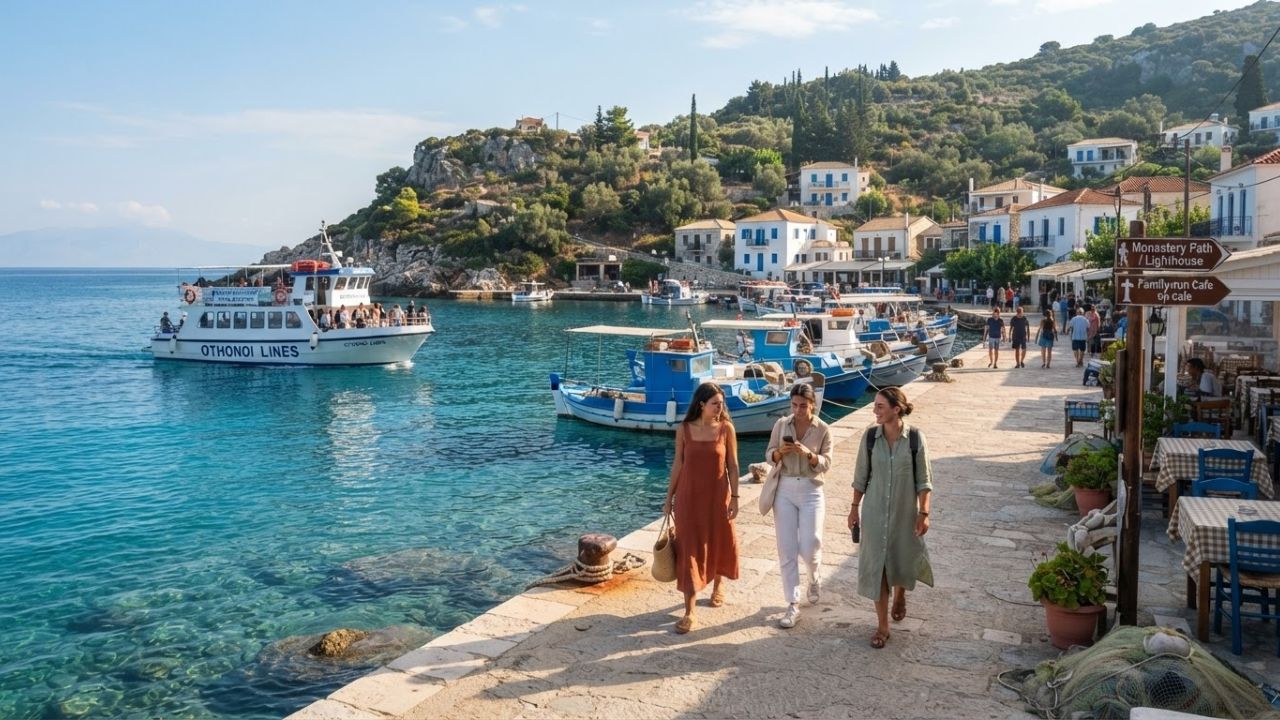
Image generated by AI
Greece has launched a sustainable tourism and maritime infrastructure initiative across the Diapontia Islands—Othonoi, Mathraki, and Ereikousa—upgrading port facilities and ferry connectivity from northern Corfu to preserve small-island heritage while supporting year-round residents.
CORFU, Greece — Seeking to balance economic vitality with ecological preservation on Greece's northwestern frontier, the Greek Ministry of Tourism and regional authorities have initiated a comprehensive development strategy for the Diapontia archipelago. Following a joint inspection tour on 24 August 2026 by Tourism Minister Olga Kefalogianni and Ionian Islands Regional Governor Yiannis Trepeklis, the Hellenic government outlined plans to upgrade maritime harbors, reinforce year-round lifeline ferry services, and implement a data-driven destination management framework.
The ministerial summit addressed structural challenges facing the three inhabited islands, including land-side transport infrastructure, harbor breakwaters, maritime linkages to Corfu, and specialized funding instruments for eco-tourism. Building on a preliminary policy meeting held in Corfu on 21 August 2026, the strategy prioritizes low-impact, high-value experiential tourism over mass-market resort development, establishing a sustainable template for Greece’s most remote maritime communities.
The Local Trend Revealed: Sustainable Port Infrastructure Unlocks Greece's Northwest Outposts
Lying northwest of Corfu in the sparkling azure waters of the Ionian Sea, the Diapontia Islands—comprising Othonoi, Mathraki, and Ereikousa—stand in stark contrast to Greece's densely visited tourism centers. Rather than pursuing high-density hotel construction, the government's newly signed Special Spatial Planning Framework for Tourism, formulated jointly by the Ministries of Tourism and Environment and Energy, establishes clear limits on commercial building density to protect the islands' distinctive physical scale and tranquil environment.
Reliable maritime connectivity sits at the core of the regional master plan:
- Othonoi (The Westernmost Greek Outpost): Situated roughly 12 nautical miles from northern Corfu with a coastline extending for around 30 kilometres, Othonoi is the largest island in the cluster. Port investments focus on deepening harbor basins and reinforcing protective seawalls to accommodate scheduled ferries and visiting sailboats during unpredictable open-sea swells.
- Mathraki (The Tranquil Haven): The smallest island of the trio, Mathraki features secluded coves, shallow sandy bays, and compact hilltop hamlets. Harbor renovations will modernize small-boat docking facilities, ensuring dependable passenger transfers from Corfu’s northern coastal ports.
- Ereikousa (The Green Sanctuary): Characterized by dense olive groves and fragrant heather, Ereikousa is receiving funding for harbor terminal improvements and electric-vehicle charging points at municipal quaysides.
To manage visitor numbers scientifically, the initiative establishes a dedicated Destination Management and Promotion Organisation (DMMO) for the Ionian Islands Region. Rather than acting solely as an advertising agency, the DMMO collects real-time mobility data, evaluates local carrying capacities, coordinates public services, and directs visitor traffic to prevent seasonal bottlenecks.
Profile of the Diapontia Islands Development Master Plan
| Island / Parameter | Geographical & Scale Metrics | Primary Development Priority | Target Tourism Experience |
|---|---|---|---|
| Othonoi | Largest island; approx. 12 nautical miles from Corfu; ~30 km coastline | Seawall reinforcement, deep-water ferry berthing, emergency helipad | Sea cave exploration, historic lighthouse hiking, sailing anchorage |
| Mathraki | Smallest island; compact settlements, shallow coves | Small-boat harbor expansion, water taxi docks, solar street lighting | Slow travel, shallow-water beachcombing, quiet olive grove walks |
| Ereikousa | Low-density northern island; sandy bays, rolling green hills | Quayside modernization, electric mobility integration, waste management | Botanical nature trails, family eco-tourism, culinary seafood tasting |
| Regional DMMO | Multi-island coordination under Ionian Islands Region | Real-time carrying capacity monitoring, environmental zoning | Off-peak autumn and spring travel promotion, heritage protection |
Cultural & Environmental Value: Slow Tourism and Community Preservation
The Diapontia development model represents a vital defense against rural depopulation across Greece's border archipelagos. By creating steady, year-round economic opportunities in accommodation, artisanal fishing, authentic tavernas, and guided marine excursions, the initiative ensures that permanent island communities remain economically viable through all twelve months of the year.
For travelers, the real impact lies in experiencing uncommercialized Ionian heritage. The islands harbor fragile marine and coastal ecosystems within the European Union's Natura 2000 conservation network, including critical foraging grounds for endangered loggerhead sea turtles (Caretta caretta) and the Mediterranean monk seal (Monachus monachus).
By channeling investment into eco-conscious walking trails, renewable energy microgrids, and local waste processing rather than sprawling resort developments, the Ministry of Tourism is establishing a model where tourism revenue directly subsidizes environmental conservation and community public services.
Local Visitor Insider Tips: Navigating the Diapontia Islands
Travelers seeking an authentic, slow-paced Ionian adventure can use Corfu as a springboard using these local recommendations:
- Ferry Departures from Northern Corfu: Traditional passenger ferries and municipal watercraft depart primarily from Agios Stefanos Avlioton and Sidari on northern Corfu. Crossing times range from 45 minutes to Ereikousa, approximately one hour to Mathraki, and up to 1.5 to 2 hours to Othonoi. In late summer and autumn, open-sea winds (Meltemi) can cause intermittent schedule changes; always verify sailings with local port authorities the evening before departure.
- Mythological & Coastal Landmarks on Othonoi: Visit the legendary Calypso Cave on the southwestern shore—traditionally revered as the mythical island of Ogygia where the sea nymph Calypso detained Odysseus for seven years. Hire a local boatman from the main port of Ammos to reach Aspri Ammos, an isolated cove framed by sheer limestone cliffs and white sand. On the northern cape, hike up to the 1872 stone lighthouse, standing over 100 meters above the sea with panoramic views across the Strait of Otranto toward Italy.
- Mathraki’s Shallow Sandbanks: Disembark at Mathraki to explore Portello Beach, a pristine, kilometers-long sandy strand where crystalline turquoise waters remain shallow for dozens of meters offshore—ideal for paddleboarding and quiet relaxation. Walk inland along historic stone footpaths linking the twin settlements of Ano Mathraki and Kato Mathraki.
- Autumn Bloom on Ereikousa: Ereikousa derives its name from reiki, the wild purple heather that blankets the hillsides in late September and October. Autumn is the optimal window to visit, offering warm swimming waters (23°C–25°C), empty sandy beaches at Porto and Bragini, and mild hiking temperatures.
- Local Corfiot-Ionian Gastronomy: Dine at family-run seaside tavernas to savor authentic regional specialties. Order bourdeto—local rockfish or scorpionfish slowly simmered in a fiery, peppery red broth—or tender beef sofrito braised with garlic, white wine, and fresh parsley. Accompany meals with chilled local Corfiot ginger beer (tsitsibira) or citrusy kumquat preserves.
- Island Etiquette & Practicalities: Cash remains essential on Mathraki and in smaller shops across Othonoi, as occasional satellite internet drops can interrupt card terminals. Respect traditional afternoon rest hours (mesimeri, 15:00 to 17:30) in quiet village squares.
Tourism Outlook: Decentralized Growth Redefines the Greek Archipelago
The coordinated investments across Othonoi, Mathraki, and Ereikousa signal an important turning point in Greek tourism policy. By utilizing Corfu’s established global airport and brand visibility as an international gateway, the Hellenic Republic is gently distributing visitor demand into its peripheral borders without overburdening island infrastructure.
As the Ionian Islands DMMO refines carrying-capacity management and upgraded ports open reliable maritime access, the Diapontia Islands offer an inspiring vision for Mediterranean travel. By prioritizing environmental scale, cultural authenticity, and local community well-being over sheer visitor volume, Greece is proving that small-scale tourism can deliver outsized value for travelers and islanders alike.
Related Travel Guides
Disclaimer
This article is for informational and educational purposes only. It does not constitute legal, financial, or professional advice. While we strive to provide accurate and up-to-date information, travel policies, regulations, and conditions change rapidly. Always verify information with official sources before making travel decisions. Nomad Lawyer makes no representations about the accuracy, reliability, completeness, or suitability of the information provided. Readers should consult qualified professionals for advice specific to their circumstances. The views expressed in this article are those of the author and do not necessarily reflect the views of Nomad Lawyer.
Raushan Kumar
Founder & Lead Developer
Full-stack developer with 11+ years of experience and a passionate traveller. Raushan built Nomad Lawyer from the ground up with a vision to create the best travel and law experience on the web.
Learn more about our team →