
US Autumn Weather Travel Alert: Hurricane Nolo Coastal Swells in Hawaii, East Coast Nor’easter, and Southwest Flash Floods

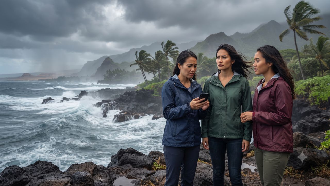
While Category 4 Hurricane Nolo tracked 380 miles south-southwest of Honolulu packing 145 mph winds, an entirely separate nor’easter struck the Atlantic seaboard with 70 mph coastal gusts, creating simultaneous, unrelated weather emergencies across opposite sides of the continent. For domestic and international travelers across the United States in late September 2026, understanding regional meteorological differences is critical to avoiding road closures, cancelled coastal ferries, and dangerous ocean rip currents.
Three Distinct Systems: Tracking September 2026 Travel Hazards
Travel conditions vary sharply depending on your destination region and local topography:
1. Hawaii: Hurricane Nolo Ocean Swells and Mountain Corridors
Although Hurricane Nolo moved west-northwest away from the islands at 12 mph (16.3°N, 160.3°W, minimum central pressure 939 millibars), trailing moisture and massive ocean swells continue to impact coastlines. A federal pre-landfall emergency declaration covers Honolulu, Hawaiʻi, Maui, and Kauaʻi counties with a 75% federal cost share. High-surf advisories predict breaking waves of 7 to 10 feet along south-facing shores and 6 to 8 feet on west-facing Big Island shores. The Hawaiʻi Department of Transportation has restricted nonessential transit on the Hāna Highway in East Maui and mobilized debris clearing teams along Highway 11 through Kaʻū, according to updates from the Hawaii Tourism Authority.
2. The Mid-Atlantic & Northeast: Nor’easter Coastal Inundation
An Atlantic coastal low generated gale-force winds and tidal flooding from New England down through the Chesapeake. In New Jersey, Governor Mikie Sherrill declared a state of emergency across eight coastal and southern counties (Atlantic, Burlington, Cape May, Cumberland, Middlesex, Monmouth, Ocean, and Salem). Tidal surges brought one to two feet of water above ground level across Lower Manhattan, Brooklyn, Staten Island, coastal Connecticut, and Virginia's Eastern Shore around Chincoteague, while Massachusetts recorded wind gusts exceeding 70 mph at Wellfleet.
3. The Southwest & Four Corners: Tropical Moisture and Flash Floods
Farther inland, tropical moisture linked to Pacific Hurricane Polo combined with upper-level low-pressure troughs, triggering multi-day flash flood watches through September 30 across New Mexico, southeastern Arizona, the Texas Panhandle, and northwest Texas monitored by the National Hurricane Center.
What Makes These Simultaneous Systems Different
| Weather Event & Region | Primary Meteorological Driver | Peak Wind / Wave Metrics | Main Travel & Transport Impact |
|---|---|---|---|
| Hawaii / Pacific | Major Hurricane Nolo (Cat 4) | 145 mph sustained; 7–10 ft surf | Big Island Hwy 11 debris, Maui Hāna Hwy warnings |
| Northeast / Mid-Atlantic | Weakening Autumn Nor'easter | 70+ mph gusts (Wellfleet, MA) | Jersey Shore emergency, NYC 1–2 ft tidal flooding |
| Southwest / Four Corners | Hurricane Polo tropical moisture | Multi-day localized heavy rain | Dry desert wash flooding, mountain highway runoffs |
Visitor Insider Tips: Traveling Safely During Active Advisories
- Stay Out of South-Facing Shorelines in Hawaii: Obey lifeguard beach closures and avoid rocky tidepools along Oahu’s south shore and the Kona coast; breaking sets can sweep dry rocks without warning.
- Monitor Coastal Ferry Timetables in New England: Ferry crossings to Nantucket, Martha’s Vineyard, and Rhode Island’s Block Island face weather holds during gale warnings; check operator status before driving to ferry terminals.
- Never Drive Across Flooded Desert Washes: In Arizona, New Mexico, and West Texas, dry desert washes (arroyos) can turn into fast-moving rivers within minutes of distant mountain rainstorms; turn around immediately rather than risking vehicle stalls.
- Verify Real-Time Road Conditions via 511: Rely on official state Department of Transportation 511 phone services and online portals rather than standard digital GPS apps, which often fail to reflect emergency road washouts promptly.
Cultural and Environmental Context: Coastal Resilience and Public Safety
Island and coastal communities have developed sophisticated disaster response networks to protect fragile historical assets and community infrastructure. In Hawaii, traditional watershed management principles (ahupuaʻa) inform modern stormwater drainage along steep volcanic ridges.
When travelers respect municipal barricades, stay off vulnerable mountain corridors, and defer unnecessary excursions during state emergencies, they protect first responders and help local road crews restore critical utility lines without interference, in alignment with emergency protocols from the National Weather Service.
FAQ: Traveling During US Autumn Weather Disruptions 2026
Did Hurricane Nolo make direct landfall in Hawaii?
No; the hurricane's eye tracked approximately 380 miles south-southwest of Honolulu, but trailing bands created high surf, strong winds, and heavy rainfall.
Which New Jersey counties were placed under a state of emergency?
The declaration covers Atlantic, Burlington, Cape May, Cumberland, Middlesex, Monmouth, Ocean, and Salem counties due to coastal flooding.
Are desert flash floods dangerous even if it is not raining overhead?
Yes; storm runoff from distant mountains can travel miles down dry canyon washes, causing sudden flash floods in sunny valley locations.
Is the Road to Hāna open during severe weather?
The Hawaiʻi Department of Transportation strongly discourages nonessential travel on the Hāna Highway during heavy rain events due to rockfalls and localized washouts.
Listening to local weather warnings and respecting the power of ocean swells ensures that an unexpected change in forecast never derails your journey.
Related Travel Guides
Disclaimer
This article is for informational and educational purposes only. It does not constitute legal, financial, or professional advice. While we strive to provide accurate and up-to-date information, travel policies, regulations, and conditions change rapidly. Always verify information with official sources before making travel decisions. Nomad Lawyer makes no representations about the accuracy, reliability, completeness, or suitability of the information provided. Readers should consult qualified professionals for advice specific to their circumstances. The views expressed in this article are those of the author and do not necessarily reflect the views of Nomad Lawyer.
Naina Thakur
Contributor & Travel Specialist
Travel enthusiast and legal writer covering visa regulations, responsible tourism, and cultural journeys across global destinations.
Learn more about our team →