
US State Department Apologizes After AI-Generated Map Mislabels African Countries at AIDS 2026 Conference
The US State Department apologized after an AI-generated map mislabeled African countries during a presentation at the AIDS 2026 conference in Rio de Janeiro, raising concerns about official AI use.

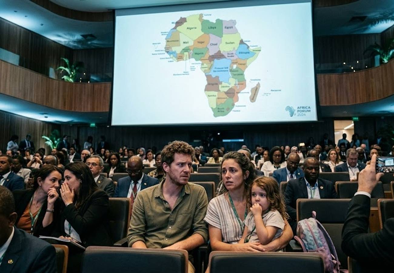
Image generated by AI
The U.S. State Department issued a formal apology after a presentation slide at the AIDS 2026 conference in Rio de Janeiro displayed a grossly inaccurate map of Africa. The error, which displaced multiple nations and bore an OpenAI watermark, highlights the growing risks of unvetted artificial intelligence in official government communications.
The Core Development
On July 26, during the 26th International AIDS Conference (AIDS 2026) in Rio de Janeiro, Brazil, a significant geographical error disrupted a high-level U.S. government presentation. Jeff Graham, the U.S. global health envoy overseeing the President's Emergency Plan for AIDS Relief (PEPFAR), presented a slide containing a map of Africa that misplaced every highlighted country.
The map did not attempt to identify all 54 countries in Africa, but every nation it did highlight was located in the wrong region. The mistake drew immediate scrutiny after an attendee photographed the slide and shared it online.
Key Facts Breakdown
Our analysis of the incident reveals several critical geographical and procedural failures:
- Nigeria: Depicted as landlocked in the Sahara Desert, despite its actual location in West Africa along the Gulf of Guinea.
- Mozambique: Moved from southeastern Africa along the Indian Ocean to the Horn of Africa.
- Côte d’Ivoire: Shifted from West Africa to the opposite side of the continent.
- Uganda and Malawi: Appeared in approximately correct regions but featured incorrect national borders.
- Cameroon: Included in a text list next to the map but lacked a clear visual connection to any landmass.
The AI Discovery and Diplomatic Backlash
AIDS expert Emily Bass attended the session and published screenshots of the slide on Substack. Matt Petit, a former State Department foreign service officer with over 16 years of experience who now specializes in AI and geopolitics at the Atlantic Council, immediately suspected artificial intelligence generation.
"I strongly suspect this is an AI-made slide," Petit wrote on LinkedIn. "Whoever created and approved this slide did not know where countries in Africa are and did not care to check their work."
Reuters later conducted an analysis confirming the map contained a watermark indicating the use of an OpenAI product. While OpenAI told Reuters it was investigating, the watermark's presence triggered severe criticism from global health leaders and diplomats.
Former U.S. Ambassador to South Africa, Patrick Gaspard, called the AI-generated map an "insult" to Africa on X. Saman Zia-Zarifi, executive director of Physicians for Human Rights, contextualized the error within broader cuts to U.S. public health support, noting the real-world harm behind the administrative incompetence.
The Official Response
After images of the slide circulated widely, the State Department acknowledged the mistake.
"We take full responsibility for the confusion and misrepresentation it caused for attendees, including our African partners," the department told Reuters.
A State Department spokesperson attributed the error to a team member who hastily altered the slide deck immediately before the presentation. The spokesperson claimed the session remained "substantive and constructive" despite the visual error, with high-level delegations from several African countries participating in local health program discussions. The department did not clarify which OpenAI product was used or if corrected materials were distributed.
Geographical Displacement Summary
| Country | Actual Location | Depicted Location on State Dept Slide |
|---|---|---|
| Nigeria | West Africa, coastline along Gulf of Guinea | North, Sahara Desert, landlocked |
| Mozambique | Southeastern Africa, along Indian Ocean | Horn of Africa |
| Côte d’Ivoire | West Africa | Opposite side of the continent |
| Uganda | East Africa | Correct region, incorrect borders |
| Malawi | Southeastern Africa | Correct region, incorrect borders |
Why This Matters
For international travelers and legal professionals relying on government data, this incident exposes a dangerous vulnerability in official communications. The State Department issues country-specific travel advisories that globetrotters depend on for security assessments. If an official presentation can deploy an AI-generated map with nations shifted thousands of miles without basic human verification, it questions the rigor applied to other critical travel data.
From a logistical perspective, this means government agencies are integrating generative AI into public-facing materials without adequate human-in-the-loop oversight. The travel industry relies heavily on geopolitical stability metrics and health advisories. When an agency tasked with monitoring PEPFAR programs across Africa cannot accurately identify the continent's geography, it erodes the foundational trust required for international mobility and international law compliance.
Industry Outlook
Expect a tightening of internal review protocols for AI-generated assets across all U.S. federal agencies. Travel and geopolitical analysts anticipate that this incident will accelerate the development of mandatory AI-watermarking standards and digital provenance tracking. For travel platforms and advisory boards, the immediate takeaway is the necessity of manual geographic verification. AI is a powerful tool for rapid content generation, but as this incident proves, unvetted AI outputs can severely damage institutional credibility and mislead the public.
Accurate geography is not a visual luxury; it is a baseline requirement for international diplomacy and travel safety.
Related Travel Guides
Disclaimer
This article is for informational and educational purposes only. It does not constitute legal, financial, or professional advice. While we strive to provide accurate and up-to-date information, travel policies, regulations, and conditions change rapidly. Always verify information with official sources before making travel decisions. Nomad Lawyer makes no representations about the accuracy, reliability, completeness, or suitability of the information provided. Readers should consult qualified professionals for advice specific to their circumstances. The views expressed in this article are those of the author and do not necessarily reflect the views of Nomad Lawyer.
Raushan Kumar
Founder & Lead Developer
Full-stack developer with 11+ years of experience and a passionate traveller. Raushan built Nomad Lawyer from the ground up with a vision to create the best travel and law experience on the web.
Learn more about our team →