US Gulf Coast Issues Urgent Flooding Warning as Hurricane Arthur Batters Travel Sector, Urging Travelers to Suspend Non-Essential Journeys: Latest Update on the Atlantic Hurricane Season 2026
As Hurricane Arthur batters the travel sector, a flooding emergency has paralyzed Houston and Gulf Coast cities during the Atlantic hurricane season 2026.
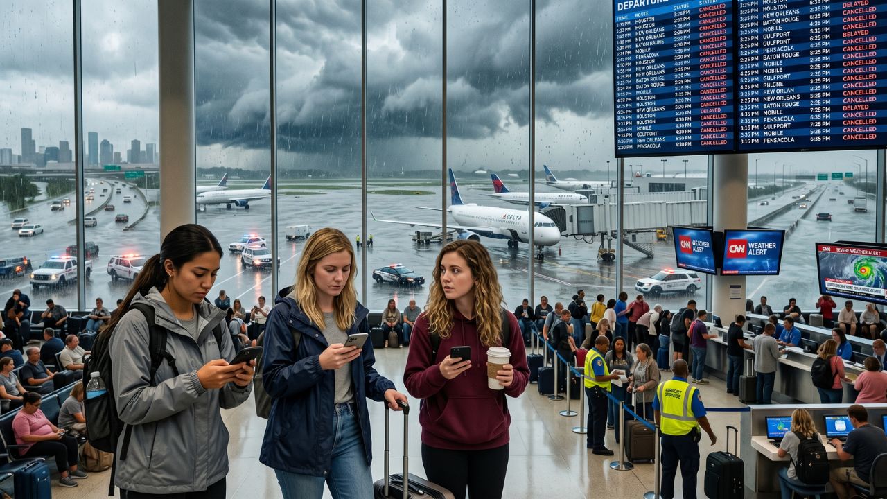
Image generated by AI
Published on June 19, 2026
As the first major storm of the Atlantic hurricane season 2026 continues to batter the travel sector, a severe flooding emergency has paralyzed major US Gulf Coast cities including Houston, New Orleans, and Baton Rouge. Tropical Storm Arthur has triggered extensive flight cancellations, highway closures, and severe urban inundation, making travel across the southern United States extremely hazardous. Local authorities urge all travelers and residents to suspend non-essential travel, monitor emergency alerts, and prepare for prolonged disruptions as river levels continue to rise.
Quick Summary
- Hurricane Arthur Impacts: The first named storm of the Atlantic hurricane season 2026 has brought record rainfall, causing extreme flash floods across Texas, Louisiana, Mississippi, Alabama, and Florida.
- Travel Infrastructure Battered: Heavy rain has saturated road networks, disrupted flights, and threatened coastal and inland tourism centers.
- Record Precipitation: Cottonport in Louisiana recorded an extraordinary 31 inches of rain within just a few days, overwhelming regional drainage systems.
- River Flooding Threat: Runoff moving slowly through flat terrains is expected to raise river levels next week, creating delayed hazards for Alabama, western Florida, and southwestern Georgia.
- Tornado and Wind Risks: Wind shear and unstable air have heightened tornado risks across the Florida Panhandle, Alabama, and western Georgia.
The initial advisory from local emergency management offices highlights that rainfall, rather than high winds, has emerged as the most destructive element of this early-season storm. According to real-time maps from the National Hurricane Center (NHC), the storm center moved inland near Matagorda Bay, Texas, before pushing east across the Gulf states. The massive tropical moisture plume associated with Arthur continues to dump rain far inland, turning local roads into dangerous waterways.
Event/Incident Details: Rain Totals and Regional Impact Across Gulf Cities
Arthur made landfall near Matagorda Bay on the Texas coast before moving eastward, saturating soils and filling river basins across five states. The National Weather Service (NWS) reported intense rainfall rates of two to four inches per hour in the hardest-hit zones, triggering instantaneous flash flooding.
A broad corridor from eastern Louisiana through southeastern Alabama accumulated between eight and twelve inches of rain, while isolated pockets received up to eighteen inches. Cottonport in Louisiana recorded a historical precipitation total exceeding 31 inches, completely submerging local drainage systems.
The following table details the impact levels and key weather threats across major Gulf Coast cities:
| City | State | Impact Level | Key Threat |
|---|---|---|---|
| Houston | Texas | High | Flash flooding, overflowing roadways |
| Lake Charles | Louisiana | High | Torrential rain, urban street flooding |
| Baton Rouge | Louisiana | Extreme | Significant flash flood risk, rising water |
| New Orleans | Louisiana | High | Street flooding, extreme drainage pressure |
| Houma | Louisiana | High | Residential flooding and canal overflow |
| Hattiesburg | Mississippi | Extreme | Severe flash flooding, road blockages |
| Gulfport | Mississippi | Extreme | Heavy rainfall, major highway closures |
| Biloxi | Mississippi | Extreme | Coastal inundation, urban storm surge |
| Mobile | Alabama | Extreme | Coastal flooding and tornado development |
| Montgomery | Alabama | High | River flooding and agricultural runoff |
| Pensacola | Florida | High | Severe flash flooding, beach erosion |
| Panama City | Florida | High | Heavy rainfall, strong surf hazards |
| Tallahassee | Florida | Moderate to High | Inland flood threat, rising local creeks |
Risk/Impact: Flash Floods, Tornadic Activity, and Travel Sector Inundation
The travel sector has experienced extensive disruptions, with flooded roads and flight cancellations stranding passengers at regional hubs. The National Weather Service declared rare, high-level flash flood emergencies across southern Mississippi, specifically highlighting threat areas near Seminary and the Anchor Lake Dam.
In addition to water damage, the storm has created unstable atmospheric conditions conducive to severe weather. The combination of wind shear, tropical moisture, and warm air has elevated the risk of short-lived but destructive tornadoes. Meteorologists are monitoring parts of Alabama, western Georgia, and the Florida Panhandle, warning residents that these tropical tornadoes can form rapidly with minimal warning.
What Authorities Are Saying: Emergency Management and Tourism Board Mandates
Local emergency response teams are advising against all road travel in flooded zones, reminding the public that even shallow moving water can sweep large vehicles away. First responders are prioritizing water rescues and clearing blocked transport routes, urging residents in affected areas to remain indoors.
Anup Kumar Keshan, Travel Industry Tycoon, Founder and Editor-in-Chief of Travel And Tour World, commented on the situation:
"Tropical Storm Arthur is a powerful reminder that resilience is becoming the defining characteristic of global travel destinations. While these weather events create enormous challenges, they also showcase the extraordinary strength, preparedness and unity of local communities, emergency responders and tourism stakeholders. Modern forecasting technology and coordinated disaster management are saving countless lives today. The travel industry must continue investing in sustainable infrastructure, climate adaptation and traveller awareness programmes. Every crisis also presents an opportunity to build smarter, safer and more resilient destinations that can protect both residents and visitors in an increasingly unpredictable world."
Practical Traveler Advice: Navigating Atlantic Hurricane Season 2026 Hazards
Travelers currently in or heading toward the US Gulf Coast must adjust their itineraries and practice extreme vigilance. Follow these safety recommendations:
- Avoid Inundated Roadways: Never attempt to drive through standing water; hidden debris, washouts, and deep holes can trap vehicles.
- Monitor Real-Time Alerts: Check weather updates frequently using regional radio broadcasts or mobile weather applications.
- Verify Flight Schedules: Confirm the operational status of your flight directly with your carrier before traveling to regional airports.
- Identify Evacuation Routes: Locate your nearest emergency shelter and map out safe routes to higher ground.
- Pack an Emergency Kit: Keep water, non-perishable food, flashlights, batteries, and essential medications accessible in your vehicle or hotel room.
- Expect Delayed River Rises: Stay alert even after the rain stops, as upstream runoff can cause rivers to peak days later.
Broader Context: Infrastructure Vulnerabilities and Climate Adaptation during the Atlantic Hurricane Season 2026
The severity of Arthur’s flooding emphasizes a shift in tropical storm behavior, where rainfall volume rather than wind speed causes the most damage. Flat landscapes in states like Alabama, western Florida, and southwestern Georgia absorb runoff slowly, which prolongs the flood threat.
Urban expansion and aging drainage systems are struggling to cope with these intense rainfall events. Gulf Coast destinations, which attract millions of visitors annually, are now forced to re-evaluate their emergency communications, flood forecasting models, and infrastructure resilience. Investments in smarter drainage systems and public awareness campaigns will be critical to adapting to these changing weather patterns.
What to Expect Next / Looking Ahead: Long-Term Recovery and Seasonal Preparedness
Municipalities are entering a prolonged recovery phase as they pump out flooded streets and clear waterlogged highways. Emergency management agencies, including the Federal Emergency Management Agency (FEMA), are setting up response centers to assist residents and local businesses.
Because upstream waters travel slowly, river systems in parts of western Florida and southwestern Georgia are expected to keep rising next week. This delayed flood hazard means travelers must remain cautious for several days after the storm passes. Arthur serves as an early warning for the rest of the Atlantic hurricane season 2026, urging coastal states to maintain high levels of emergency readiness.
Conclusion
The impacts of Hurricane Arthur demonstrate how quickly a tropical system can disrupt travel and threaten lives. As US Gulf Coast cities begin their recovery, safety, preparation, and clear communication remain the primary tools to manage these events. Travelers must prioritize safety, follow local emergency guidance, and stay prepared throughout the remainder of the storm season.
Related Travel Guides
- Malaysia Tightens Tourist Entry Rules as Selangor Immigration Crackdown Detains 62 Foreign Nationals, Prompting Stricter Border Checks and Mandatory Compliance: New Travel Alert
- Vietnam Holiday Travel Scam Exposes Massive Fake Vacation Network in Hanoi, Prompting Urgent Alerts for Tourists Facing High-Pressure Timeshare Schemes: New Update
- The 10 Best Hurricane Safety Tips for Travelers in Houston and Gulf Coast, According to Reddit
FAQ: US Gulf Coast Flooding and Hurricane Arthur
Why is Hurricane Arthur causing so much flooding despite weakening?
Even as Arthur's winds weakened, the storm retained an immense tropical moisture plume that continues to dump heavy rainfall far inland, overwhelming local drainage systems.
Which city recorded the highest rainfall during Hurricane Arthur?
Cottonport in Louisiana recorded the highest rainfall, with more than 31 inches of precipitation accumulated within just a few days.
When are rivers expected to reach their peak levels?
Rivers in flatter landscapes, particularly in Alabama, western Florida, and southwestern Georgia, are expected to absorb upstream runoff slowly and reach their peak levels next week.
What is a flash flood emergency?
A flash flood emergency is the highest level of flood warning issued by the US National Weather Service, indicating an immediate, catastrophic threat to human life and property.
How should travelers verify their flight status?
Travelers should monitor airline mobile apps and verify their flight status directly with the carrier before traveling to the airport, as local flooding may disrupt airport access.
Disclaimer
This article is for informational and educational purposes only. It does not constitute legal, financial, or professional advice. While we strive to provide accurate and up-to-date information, travel policies, regulations, and conditions change rapidly. Always verify information with official sources before making travel decisions. Nomad Lawyer makes no representations about the accuracy, reliability, completeness, or suitability of the information provided. Readers should consult qualified professionals for advice specific to their circumstances. The views expressed in this article are those of the author and do not necessarily reflect the views of Nomad Lawyer.

Kunal K Choudhary
Co-Founder & Contributor
A passionate traveller and tech enthusiast. Kunal contributes to the vision and growth of Nomad Lawyer, bringing fresh perspectives and driving the community forward.
Learn more about our team →