Romania’s Via Transilvanica Shocks Europe as 1,400 km Wild Hiking Corridor Through Transylvania, Carpathians and Ancient Villages Challenges the Camino de Santiago
Romania’s Via Transilvanica Shocks Europe as 1,400 km Wild Hiking Corridor Through Transylvania, Carpathians and Ancient
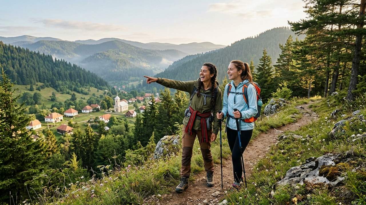
Image generated by AI
Romania’s 1,400km Via Transilvanica Trail Redefines European Hiking With Cross-County Cultural Corridor Through Carpathians and Ancient Villages
BUCHAREST, June 21, 2026 — Romania’s Via Transilvanica hiking corridor now spans 1,400 kilometres across ten administrative regions, positioning the initiative as a direct alternative to established European pilgrimage routes. Official tourism documentation confirms the continuous trail connects northern borderlands near Putna to the Danube basin, delivering an immersive wilderness experience that deliberately bypasses heavily commercialized tourist zones. Industry observers note the route immediately challenges long-distance trekking markets by prioritizing unspoiled Carpathian landscapes and decentralized rural infrastructure.
The project operates as a national-scale eco-tourism infrastructure initiative designed to cross ten counties and more than 400 rural communities. Authorities frame the corridor not merely as a recreational walking path, but as a structured system for rural regeneration, cultural preservation, and sustainable tourism expansion. Field reports indicate that planners intentionally routed the trail through historically layered territories to distribute visitor traffic away from congested urban centers. This geographic distribution strategy aims to stabilize regional economies while protecting fragile ecosystems from mass tourism pressure.
Carpathian Geography and Historical Regions Shape the 1,400 Kilometre Route
Official heritage documentation categorizes the corridor into six distinct cultural and geographic zones, each reflecting Romania’s complex historical tapestry. The route traverses Bukovina, Terra Siculorum, Terra Saxonum, Terra Dacica, Terra Banatica, and Terra Romana, creating a continuous walking system that links high mountain elevations, rolling plateau formations, and lowland river valleys. Hikers experience a complete geographical transformation within a single journey, moving from dense northern forests and monastic heritage zones into central fortified villages and medieval Saxon architectural settlements. Southern segments introduce dramatic limestone gorges and protected national park territories before terminating at the Danube corridor.
The trail crosses Suceava, Bistrița-Năsăud, Mureș, Harghita, Brașov, Sibiu, Alba, Hunedoara, Caraș-Severin, and Mehedinți counties, establishing a continuous ecological transition that remains rare among European long-distance paths. Aviation and tourism analysts emphasize that this cross-regional connectivity allows the corridor to function as a compressed representation of Romania’s natural and cultural identity. The deliberate routing ensures that travelers encounter diverse topographical features without requiring complex logistical transfers, thereby reducing carbon emissions associated with intercity transport.
Hand-Carved Stone Markers Create an Open-Air Cultural Installation
A defining characteristic of the corridor is its continuous kilometre marker system, which replaces standard numerical signage with individually hand-carved stone sculptures. Each marker functions simultaneously as a navigation aid, an artistic interpretation of local identity, and a cultural symbol representing regional traditions. Heritage officials describe the installation as a large-scale open-air cultural corridor where sculpture and natural landscape merge into a unified visitor experience. The decentralized design ensures that every walking segment carries distinct visual and historical weight, preventing route fatigue during extended multi-day treks.
Survey data from early trail users indicates that the artistic installation significantly increases engagement with peripheral villages that lack conventional tourist infrastructure. Local artisans frequently source materials from nearby quarries and rivers, embedding traditional craftsmanship directly into the walking experience. This approach transforms the corridor from a simple recreational path into a structured cultural exhibition distributed across the entire geography of the country. The markers also serve as wayfinding anchors for emergency services and trail maintenance crews operating in remote mountain zones.
Rural Villages and Local Economies Drive Community-Based Tourism
The corridor operates as a community-driven tourism framework that integrates more than 400 villages and rural settlements into its daily operational structure. Local households provide accommodation, food services, and cultural interaction points, enabling direct economic participation from residents in areas historically affected by population decline. Tourism boards report that the model explicitly discourages the development of isolated resort-style zones, instead embedding visitor spending within everyday rural economies. Family-run guesthouses and homestays receive priority placement in official trail guides, ensuring that tourism revenue circulates directly among local producers and service providers.
Economic assessments indicate that this decentralized distribution model strengthens regional resilience by preventing wealth concentration in urban hubs. Traditional crafts, local gastronomy, and small-scale agricultural production gain visibility through structured trail partnerships, allowing rural communities to monetize cultural assets without external corporate intermediaries. The framework also creates seasonal employment opportunities for trail maintenance, hospitality management, and guided cultural tours. Industry analysts note that the system establishes a replicable template for rural regeneration that other European nations are currently evaluating for implementation.
Slow Travel Framework Establishes New Sustainability Benchmarks
The corridor aligns with Europe’s expanding slow travel and eco-tourism movement by encouraging extended visitor stays, reduced environmental impact, and immersive cultural engagement. Planning documents outline four core sustainability pillars: low-impact hiking and cycling infrastructure, decentralized accommodation networks, minimal urban dependency, and strict conservation of natural zones. Trail designers mapped visitor corridors in advance to prevent uncontrolled tourism pressure on sensitive ecosystems, thereby protecting biodiversity hotspots within the Carpathian range. The route actively discourages rapid sightseeing in favor of prolonged immersion, which research shows correlates with lower per-capita resource consumption.
Environmental monitoring teams report that the structured pathway significantly reduces off-trail erosion and habitat disruption compared to unregulated trekking zones. Waste management protocols require visitors to utilize established collection points, while local municipalities coordinate seasonal cleanup initiatives funded by trail usage fees. The framework also integrates renewable energy standards for newly constructed trailhead facilities, ensuring that supporting infrastructure does not compromise surrounding wilderness quality. Tourism economists project that the model will attract high-value visitors willing to pay premium rates for authentic, low-impact experiences, thereby offsetting maintenance costs without requiring heavy state subsidies.
Strategic Infrastructure Positions Romania Within European Adventure Markets
Officials view the corridor as a long-term strategic asset within national tourism development roadmaps, functioning simultaneously as physical infrastructure and a cultural branding mechanism. The route enhances Romania’s visibility across four primary sectors: long-distance trekking tourism, cultural heritage tourism, nature-based adventure travel, and rural regeneration models. Planners have outlined phased infrastructure upgrades, including expanded digital mapping systems, improved signage standardization, and deeper integration with international hiking network certifications. These enhancements aim to position the corridor as a competitive alternative to established European pilgrimage routes while maintaining a distinctly less commercialized visitor experience.
Market analysts indicate that the project’s scale and design allow Romania to capture growing demand for wilderness tourism that prioritizes authenticity over mass accessibility. The trail’s continuous cross-regional routing reduces dependency on major airport hubs, encouraging visitors to enter through smaller regional transit points and distribute spending across multiple counties. Future development phases will prioritize connectivity with neighboring country trekking networks, potentially creating transboundary hiking corridors that extend the route’s economic and cultural reach. Industry observers consider the initiative a benchmark for how nations can leverage geographic and cultural assets to compete in the global adventure travel sector.
The corridor represents a structural shift in European long-distance tourism, combining ecological diversity, cultural depth, and community integration into a single continuous pathway. Planners are currently finalizing digital navigation upgrades and cross-border connectivity agreements to expand the route’s international accessibility. The project’s emphasis on decentralized economic participation and environmental conservation will likely influence future tourism funding allocations across the region. Stakeholders expect sustained visitor growth as trail certifications mature and international marketing campaigns target high-value slow travel demographics.
Romania’s 1,400km Via Transilvanica hiking route redefines European long-distance trekking with a sustainable, community-driven corridor connecting Carpathian wilderness to historic rural settlements across ten counties.
Related Travel Guides
Disclaimer
This article is for informational and educational purposes only. It does not constitute legal, financial, or professional advice. While we strive to provide accurate and up-to-date information, travel policies, regulations, and conditions change rapidly. Always verify information with official sources before making travel decisions. Nomad Lawyer makes no representations about the accuracy, reliability, completeness, or suitability of the information provided. Readers should consult qualified professionals for advice specific to their circumstances. The views expressed in this article are those of the author and do not necessarily reflect the views of Nomad Lawyer.

Preeti Gunjan
Contributor & Community Manager
A passionate traveller and community builder. Preeti helps grow the Nomad Lawyer community, fostering engagement and bringing the reader experience to life.
Learn more about our team →