
Travel Advisories: Reno Wildfire Triggers Evacuation Orders
Reno's fast-moving Hawk Fire expands to over 10,500 acres on August 23, 2026, forcing evacuations of nearly 14,000 homes and closing US Route 395.

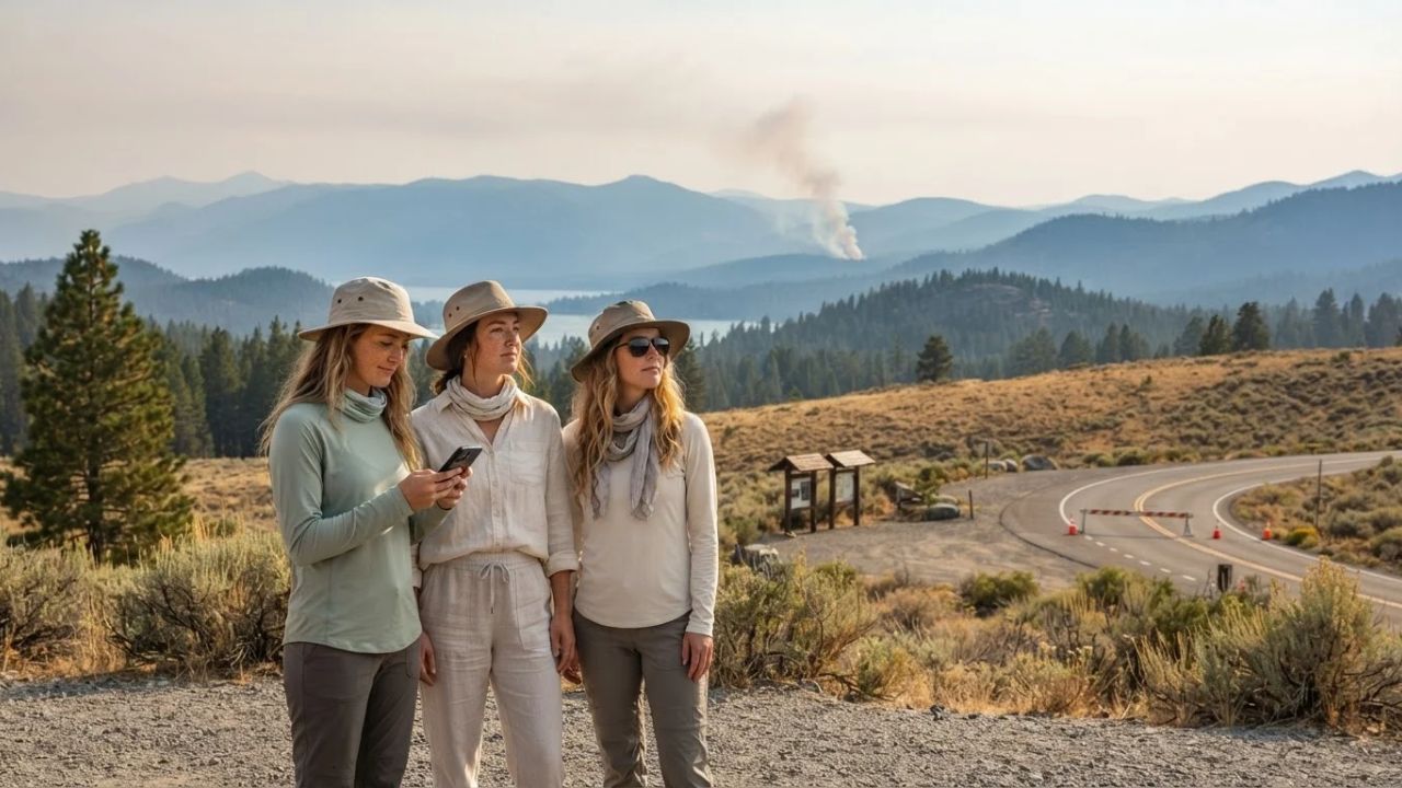
Image generated by AI
Reno's fast-moving Hawk Fire expands to over 10,500 acres on August 23, 2026, forcing evacuations of nearly 14,000 homes and closing US Route 395. The National Interagency Fire Center (NIFC) indicates that strong winds and dry vegetation coordinate rapid fire spread, placing the western travel corridor under the highest national preparedness level.
The Transition of Western Destinations to Wildfire Mitigation Corridors
A significant trend in western US outdoor travel planning is the transition of mountain vacation gateways into active wildfire mitigation corridors. Historically, regional tourism boards promoted forest recreation and backcountry highway trips throughout August, ignoring the seasonal risks of dry timber and late-summer lightning storms. In 2026, climate conditions require emergency planners and transport departments to declare state-level emergencies, implementing road closures and evacuating entire residential blocks to prioritize public safety.
By directing tourists away from fire zones, emergency personnel manage local traffic. This safety-focused model protects rural communities, mountain resorts, and regional transit systems.
Hawk Fire Outbreak and Reno-Tahoe Disruption Parameters
The fire incident escalated rapidly in the Sierra Nevada foothills:
- Outbreak Escalation Date: Early Sunday, August 23, 2026.
- Total Burned Area: Expanded past more than 10,500 acres in Washoe County.
- Evacuation Volume: Evacuation orders issued for nearly 14,000 homes, including neighborhoods near the University of Nevada, Reno (UNR) campus.
- Grid Disruption: Left nearly 10,000 homes and businesses without electrical power.
- Highway Closure: Portions of U.S. Route 395 closed to non-emergency traffic.
- Emergency Resource Deployment:
- Fire Personnel: Around 400 personnel deployed on the ground.
- Nevada National Guard: 60 National Guard troops and two helicopter crews mobilized by Governor Joe Lombardo.
- Evacuation Shelter: Reno-Sparks Convention Center opened for displaced residents.
- Urban Proximity: Reno has more than 280,000 residents, with UNR hosting approximately 24,000 students (based on autumn 2025 enrollment).
- Airport Status: Reno-Tahoe International Airport remains outside the evacuation zone with flights operating, while the smaller Reno-Stead Airport was closed to general aviation to support firefighting aircraft.
While regional commercial flights continue, road access and nearby accommodation availability remain highly volatile.
2026 National Wildfire Status and Regional Impacts
The incident in Nevada is part of a broad, active fire season across the United States:
- National Statistics (NIFC): Recorded more than 50,000 wildfires and over 7.6 million acres burned in 2026.
- National Preparedness Level: Maintained at Preparedness Level 5 (the highest response level).
- Active Regional Fire Scopes:
- Oregon: Mount Hood (Grasshopper Fire) and Central Oregon experiencing closures and smoke.
- Washington: North Cascades (Little Giant Fire) and Mount Rainier (Grand Park 2 Fire).
- Idaho: Boise area (Crooked Fire active east of Idaho City).
- Colorado: Pueblo (Aspen Acres Fire) and high-country routes near Lake City and Ouray.
- California: Big Sur coast (Timber Fire) and Northern California (MP18 Fire near Hoopa).
- Alaska: Tok region (Mukluk Fire).
- New Mexico: Santa Fe region (Frijoles Fire).
These fire locations require travelers to check local forest service updates when planning mountain road trips.
US Wildfire Tourism and Emergency Coordination Coordinates
The table below breaks down the travel destinations, active fire incidents, burned areas, closed transport lines, regional partners, and coordinating authorities recorded on August 23, 2026:
| Travel Destination | Active Fire Incident | Burned Area Acreage | Closed Transport Line | Regional Partner | Coordinating Authority |
|---|---|---|---|---|---|
| Reno Nevada | Hawk Fire emergency | More than 10,500 acres | U.S. Route 395 sections | Reno-Tahoe Airport | Washoe County Emergency |
| Lake Tahoe region | Sierra foothills blaze | Over 7.6M acres (US total) | Reno-Stead Airport (GA) | Reno-Sparks Convention | Nevada National Guard |
| Western US forests | Regional park blazes | PL5 national alert level | Sierra forest trails | InciWeb Incident System | National Interagency Fire |
These coordinates outline the destinations, incidents, areas, lines, partners, and authorities established for the emergency programs.
Resource Stewardship and Eco-Aware Western Travel
For the traveler, the benefit of practicing resource stewardship during a wildfire emergency is keeping roads clear of unnecessary tourist traffic, allowing fire trucks and evacuees to move quickly. Checking the digital AirNow Fire and Smoke Map instead of driving through smoky valleys helps prevent emergency health calls.
Additionally, respecting temporary campfire bans in national forests prevents new accidental fires in dry regions. Booking accommodations at hotels that offer discount rates for displaced residents directly supports the community emergency response.
For comparison, you can explore the changing dynamics of Stimulus Launch: Taiwan Unveils Billion-Dollar Repeat Visitor Rewards to see how destinations promote visitor spend. For transit updates, comparing travel scheduling matches other networks, such as Destination Campaigns: Florida Gulf Coast Beaches Record Surge in Tourism updates. This trend is similar to the tourism growth seen in other destinations, as detailed in our guide on the Hacienda Heights Bus Fire Transport Safety regulations.
Traveler Insider Tips: Managing Wildfire Safety
If you are planning to travel through the western United States, keep these practical tips in mind:
- Follow Evacuation Orders Immediately: Follow instructions from Washoe County emergency officials immediately; do not delay departure to inspect the fire.
- Monitor Road Closures Online: Check current highway maps before starting your trip, as portions of US 395 can be closed.
- Check the AirNow Smoke Map: Check the AirNow map to monitor air quality, as smoke can affect regions far from the active fire.
- Confirm Hotel Reservations: Contact your accommodation provider before arriving in Reno, as local hotels may be full hosting evacuees.
- Use InciWeb for Incident Updates: Check the official InciWeb site for real-time information on active containment lines and trail closures.
Long-Term Outlook for Western Forest and Travel Management
The long-term outlook for transit in western forest belts is focused on installing real-time fire cameras, undergrounding electrical grids in high-risk zones, and developing regional evacuation bypass roads. As late-summer fire seasons grow longer, national forest services and state transport boards will cooperate to maintain passenger standards.
By developing sustainable transit options and protecting forest habitats, the transportation sector aims to build a sustainable transport network.
FAQ
What is the current status of the Hawk Fire near Reno?
The Hawk Fire has burned over 10,500 acres in the Sierra foothills, prompting evacuation orders for nearly 14,000 homes in Washoe County.
Are commercial flights operating at Reno-Tahoe International Airport?
Yes. The airport remains outside the evacuation zone with flights operating, though general aviation flights at Reno-Stead Airport are suspended to support firefighting craft.
What transport lines are closed because of the Reno fire?
Emergency officials closed portions of U.S. Route 395, and general aviation is restricted at Reno-Stead Airport.
What is the national preparedness level for US wildfires?
The National Interagency Fire Center (NIFC) has set the national preparedness level to Level 5, the highest response level, due to multiple large fires across the West.
Stay updated on regional travel regulations and fire safety alerts shaping western transit.
Related Travel Guides
Disclaimer
This article is for informational and educational purposes only. It does not constitute legal, financial, or professional advice. While we strive to provide accurate and up-to-date information, travel policies, regulations, and conditions change rapidly. Always verify information with official sources before making travel decisions. Nomad Lawyer makes no representations about the accuracy, reliability, completeness, or suitability of the information provided. Readers should consult qualified professionals for advice specific to their circumstances. The views expressed in this article are those of the author and do not necessarily reflect the views of Nomad Lawyer.
Raushan Kumar
Founder & Lead Developer
Full-stack developer with 11+ years of experience and a passionate traveller. Raushan built Nomad Lawyer from the ground up with a vision to create the best travel and law experience on the web.
Learn more about our team →