
Border Controls: Point Reyes Closes Beach After Fishing Boat Grounding
Point Reyes National Seashore closes North Beach after the 58-foot fishing boat Lake Bay runs aground on August 21, 2026, carrying 1,000 gallons of fuel.

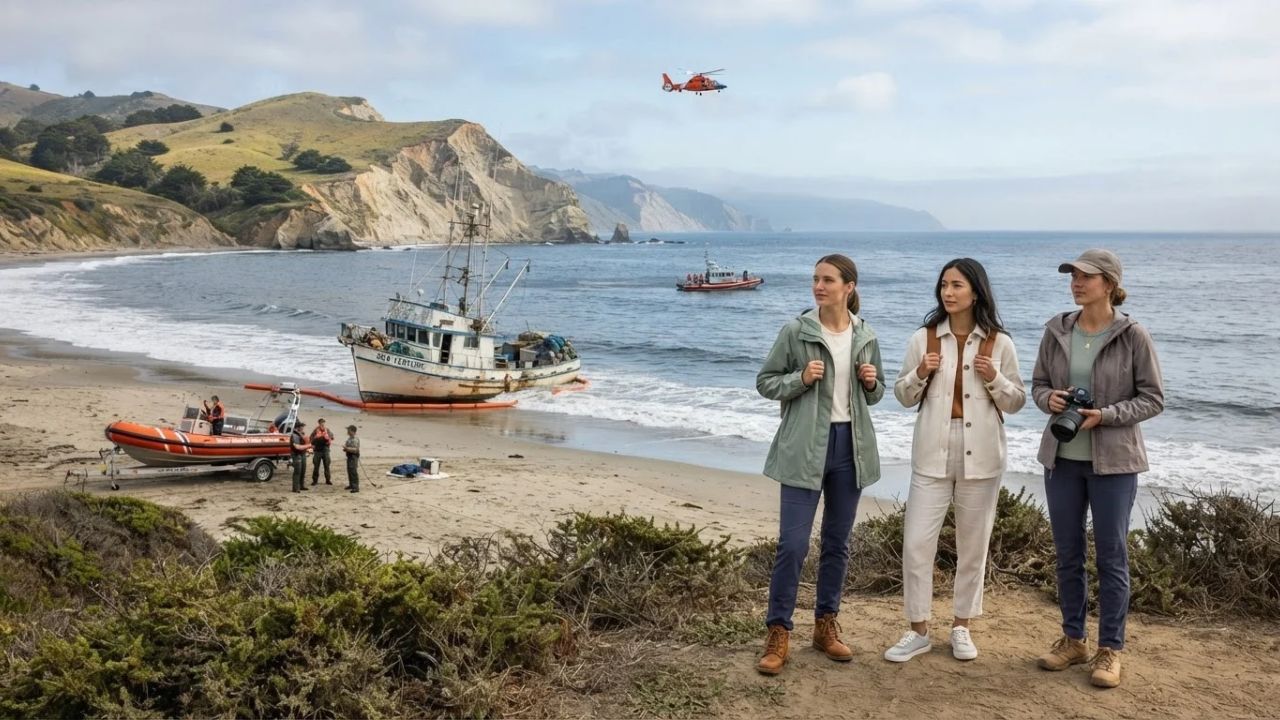
Image generated by AI
Point Reyes National Seashore closes North Beach after the 58-foot fishing boat Lake Bay runs aground on August 21, 2026, carrying 1,000 gallons of fuel. The National Park Service indicates that closing beach access protects first responders during salvage rigging, securing the wilderness shoreline from potential marine fuel leaks.
The Transition of Protected Seashores to Precautionary Emergency Zones
A significant trend in coastal park management is the transition of protected seashores into precautionary emergency zones during maritime accidents. Historically, regional park directors managed offshore groundings with passive monitoring, allowing vessels to remain on beaches until private insurers arranged salvage teams, which often resulted in fuel leaks and shoreline contamination. In 2026, conservation ministries implement rapid incident protocols, establishing unified commands to seal beach access points and extract fuel loads within hours of a distress call.
By closing shoreline sections to protect first responders, park authorities prevent coastal pollution and manage tourist movements. This safety-first model protects coastal wilderness habitats, local seafood fisheries, and regional visitor economies.
Point Reyes Vessel Grounding and Response Parameters
The marine incident occurred on the northern coast of Marin County, California:
- Incident Date: Friday morning, August 21, 2026.
- Vessel Details: A 58-foot commercial fishing vessel named Lake Bay carrying 5 people (no injuries reported).
- Location of Grounding: Near Ten Mile Beach, within the boundaries of Point Reyes National Seashore.
- Fuel Load On Board: Carrying approximately 1,000 gallons of diesel fuel (out of a maximum capacity of 2,800 gallons).
- Responding Agencies: US Coast Guard (Station Bodega Bay, Station Golden Gate, Air Station San Francisco), National Park Service, Marin County Fire, NOAA, and the California Department of Fish and Wildlife Office of Spill Prevention and Response (OSPR).
- Deployable Rescue Craft: An MH-65 Dolphin helicopter and a 47-foot Motor Lifeboat monitored the site.
- Closed Shoreline Area: North Beach remains temporarily closed to the public during fuel removal.
Responders report no active fuel leaks or impacts to local marine wildlife at this stage.
Point Reyes National Seashore Visitor and Economic Metrics
The temporary closure unfolds during a busy summer visitor season:
- Annual Recreation Visits:
- 2024: 2,371,800 visits.
- 2023: 2,268,058 visits.
- 2022: 2,336,202 visits.
- 2021: 2,738,098 visits.
- 2015–2024 Annual Average: about 2.4 million visits.
- Peak Season Monthly Visitor Averages (2015–2024):
- July: 273,808 visits.
- August: 255,739 visits.
- September: 213,701 visits.
- Coastal Park Dimensions: Covers roughly 71,055 acres, including about 32,730 acres of designated wilderness, approximately 80 miles of shoreline, and about 150 miles of hiking trails.
- Regional Economic Footprint (2022 NPS Analysis): Visitor spending generated $117 million in nearby communities, supporting approximately 1,120 local jobs and producing a cumulative benefit of $149 million within 60 miles of the park.
- National Context (2025): US national seashores handled more than 22.6 million visits, representing about 7% of all National Park System recreation visits.
These metrics show that maintaining visitor access is vital for the gateway economies of West Marin.
Point Reyes Coastal Emergency Response Coordinates
The table below breaks down the response sectors, fuel storage levels, visitor traffic averages, regional partners, and coordinating authorities recorded on August 23, 2026:
| Response Sector | Fuel Load Level | Monthly Visitor Traffic | Coastal Access Route | Regional Partner | Coordinating Authority |
|---|---|---|---|---|---|
| Marine salvage | 1,000 gal diesel aboard | 255,739 August average | Ten Mile Beach zone | OSPR Spill Response | United States Coast Guard |
| Shoreline safety | Max capacity: 2,800 gal | 273,808 July average | North Beach access | Marin County Fire | National Park Service |
| Wildlife protection | Zero active spills reported | 213,701 September average | Approximately 80mi coast | NOAA Fisheries | Calif Dept Fish & Wildlife |
These coordinates outline the sectors, fuel volumes, visitor traffic, locations, partners, and authorities established for the recovery program.
Resource Stewardship and Eco-Aware Coastal Travel
For the traveler, the benefit of practicing resource stewardship during a coastal emergency is keeping roads clear for fuel extraction trucks and rescue vehicles. Planning hikes on southern trails (such as the Bear Valley Trail) instead of heading toward North Beach reduces traffic at northern trailheads.
Additionally, keeping food scraps secured protects local wildlife, such as ravens and foxes, from becoming habituated to visitor activity. Selecting local hotels in Point Reyes Station or Inverness ensures tourism spending directly supports gateway communities.
For comparison, you can explore the changing dynamics of Stimulus Launch: Taiwan Unveils Billion-Dollar Repeat Visitor Rewards to see how destinations promote visitor spend. For transit updates, comparing travel scheduling matches other networks, such as Aviation Expansion: American Airlines Launches Four DFW Routes updates. This trend is similar to the tourism growth seen in other destinations, as detailed in our guide on the Hacienda Heights Bus Fire Transport Safety regulations.
Passenger Insider Tips: Navigating Point Reyes Closures
If you are planning to visit Point Reyes National Seashore, keep these practical tips in mind:
- Confirm Beach Openings Online: Check the official NPS current conditions page before starting your drive to West Marin.
- Respect All Barrier Signs: Do not enter closed areas at North Beach, as heavy machinery and fuel salvage operations require clear access.
- Be Prepared for Coastal Fog: Pack warm clothing, as coastal temperatures average around 18°C during the day and drop to 11°C overnight.
- Learn the Wildlife Protection Rules: Keep a safe distance from western snowy plover nesting areas and elephant seal colonies to support local conservation.
- Have an Alternative Itinerary: Prepare a backup hike on the park's 150 miles of trails in case your preferred beach is closed.
Long-Term Outlook for Point Reyes Coastal Management
The long-term outlook for transit in Point Reyes is focused on reinforcing coastal seawalls, replacing deteriorating boundary fences, and developing real-time visitor alert applications. As maritime traffic and environmental challenges continue to affect the Pacific coastline, national park administrators and state conservation offices will cooperate to maintain passenger standards.
By developing sustainable transit options and protecting coastal wilderness, the tourism sector aims to build a sustainable transport network.
FAQ
Why is North Beach closed at Point Reyes?
The National Park Service closed the beach to allow emergency crews to safely remove fuel from the grounded fishing boat Lake Bay.
What ship ran aground at Point Reyes?
The Lake Bay, a 58-foot commercial fishing vessel carrying five crew members, ran aground near Ten Mile Beach on August 21, 2026.
How much fuel was on board the vessel?
The vessel carried approximately 1,000 gallons of diesel fuel at the time of the grounding, out of a maximum capacity of 2,800 gallons.
Are there any reports of oil spills or injured wildlife?
No. Coast Guard incident commander Lt. Cmdr. Carey Lewis confirmed that no active fuel leaks, environmental damage, or wildlife impacts have been reported.
Stay updated on regional travel regulations and environmental safety alerts shaping California transit.
Related Travel Guides
Disclaimer
This article is for informational and educational purposes only. It does not constitute legal, financial, or professional advice. While we strive to provide accurate and up-to-date information, travel policies, regulations, and conditions change rapidly. Always verify information with official sources before making travel decisions. Nomad Lawyer makes no representations about the accuracy, reliability, completeness, or suitability of the information provided. Readers should consult qualified professionals for advice specific to their circumstances. The views expressed in this article are those of the author and do not necessarily reflect the views of Nomad Lawyer.
Raushan Kumar
Founder & Lead Developer
Full-stack developer with 11+ years of experience and a passionate traveller. Raushan built Nomad Lawyer from the ground up with a vision to create the best travel and law experience on the web.
Learn more about our team →