
Transit Disruption: Hawk Fire near Reno Surges past 10,500 Acres

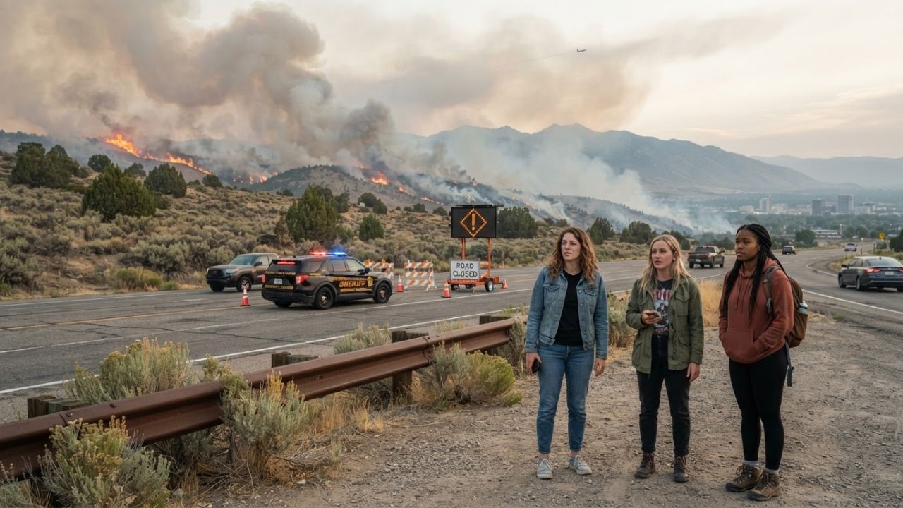
Image generated by AI
The rapid expansion of the Hawk Fire north of Reno, Nevada, has forced the closure of US 395, prompted power line shutdowns for 37,000 customers, and placed approximately 1,000 homes under urgent evacuation orders as burned acreage exceeds 10,500 acres.
RENO, Nevada — Wind-driven wildfire activity north of Reno has escalated into a major regional emergency, with the Hawk Fire burning more than 10,500 acres across Washoe County. Driven by strong winds reaching up to 40 mph and relative humidity levels dipping to 12 per cent, emergency crews from the Truckee Meadows Fire Protection District are contending with extreme fire behavior that threatens residential communities, regional utility grids, and primary interstate highway corridors.
The blaze has triggered mandatory evacuation orders across northern Washoe County while extending evacuation warnings over the state line into Sierra County, California. As emergency responders prioritize life safety and structure defense, key transportation arteries—including US 395 between Parr Boulevard and Red Rock Road—remain closed, creating severe travel disruptions for residents, visitors, and freight operators connecting Reno with the Lake Tahoe region.
Hawk Fire Enters Dangerous Phase North of Reno
Originating on hillside terrain north of Reno, the Hawk Fire expanded rapidly from an initial estimate of 2,500 to 3,000 acres up to more than 10,500 acres by Saturday evening. Pushed by persistent gusty winds toward the northeast, the fire has consumed sagebrush, timber, and rural structures along its path.
Fire officials described the operational environment as dynamic and unpredictable. The National Weather Service issued a Red Flag Warning for Northern Washoe County, warning that sustained winds of 15 to 25 mph, combined with 40 mph gusts and single-digit humidity trends, create ideal conditions for rapid flame spread and spot fires.
Fire crews continue working along active perimeters to establish containment lines, but erratic wind shifts continue to complicate ground and aerial firefighting operations.
US 395 Highway Closures and Cross-Border Evacuation Orders
The most immediate disruption for regional travel is the emergency closure of US 395, a major north-south transportation corridor linking Reno with Northern California and the Pacific Northwest. Highway authorities closed the route between Parr Boulevard and Red Rock Road to prevent civilian traffic from entering active burn areas and to maintain clear access for emergency apparatus.
The road closure has immediate knock-on effects across the interconnected Reno-Tahoe tourism market. Visitors attempting to travel between downtown Reno casinos, North Lake Tahoe resorts, and regional outdoor recreation zones face extensive detours via secondary rural roads.
Evacuation orders remain active for approximately 1,000 homes in Nevada, while emergency officials in Sierra County, California, have issued warning advisories as smoke and fire activity approach the border. Highway patrol officials urge motorists to avoid attempting unverified detours, as fire conditions can alter road safety within minutes.
Electrical Power Grid Shutdowns Affect 37,000 Customers
In addition to highway closures, electric utility providers executed emergency power shutdowns to prevent damaged electrical lines from igniting additional fires and to protect line crews working near active flames. De-energized transmission lines cut power to approximately 37,000 customers across the Truckee and North Lake Tahoe regions.
The blackout impacted nearly 15,000 customers served by the Truckee Donner Public Utility District and roughly 22,000 customers under Liberty Utilities. The loss of electrical service creates severe operational challenges for local hospitality businesses, interrupting refrigeration, electronic payment processing, communications, and air conditioning.
Hotels and short-term rental operators in affected zones are coordinating with local emergency management agencies to assist displaced residents and visitors seeking temporary lodging outside the blackout area.
Reno-Tahoe International Airport Air Travel and Smoke Status
Despite the proximity of the wildfire to urban Reno, Reno-Tahoe International Airport (RNO) continues to operate flights, serving as a critical transport link during ground highway closures. Handling over 130 daily arrivals and departures across 10 commercial airlines, RNO provides nonstop connections to major domestic hubs including Atlanta, Chicago, Dallas, Denver, Los Angeles, New York, Phoenix, San Francisco, and Seattle, alongside international flights to Guadalajara via Volaris.
However, aviation officials caution that flight operations remain subject to change based on wildfire smoke density and wind direction. Heavy smoke plumes tracked by the Environmental Protection Agency's AirNow system can reduce low-altitude visibility and cause temporary flight delays or ground holds.
Passengers traveling through RNO should verify flight status directly with their airline before proceeding to the terminal, while ensuring ground travel routes to the airport remain open.
Washoe County Wildfire History and Acreage Benchmark Matrix
The summary table below compares the current Hawk Fire against major recent wildfire events in Washoe County, detailing acreage burn figures, primary locations, evacuation impacts, and utility disruptions:
| Wildfire Incident | Fire Size (Acreage) | Primary Regional Location | Evacuation & Structure Impact | Power Infrastructure Status | Primary Response Agency |
|---|---|---|---|---|---|
| Hawk Fire (2026) | 10,500+ acres | North of Reno, Washoe County | 1,000 homes threatened; US 395 closed | 37,000 customers de-energized | Truckee Meadows Fire District |
| Bug & Fred Mtn (2026) | 16,000+ acres | Northern Washoe County peaks | 6,000+ residents evacuated | Regional line alerts issued | Nevada Division of Forestry |
| Baccarat Fire (2020) | 10,500 acres | Hillsides north of Reno | Area warnings issued; zero homes lost | Normal power operations maintained | Washoe Emergency Management |
| Pinehaven Fire (2020) | 512 acres | Pinehaven neighborhood, Reno | 5 homes destroyed; 1,300 evacuated | Local distribution line damage | City of Reno Fire Department |
Practical Implications for Travelers and Reno-Tahoe Visitors
For travelers currently in or heading toward Northern Nevada, the Hawk Fire transforms routine trip planning into an active safety exercise. Relying on outdated navigation apps can lead drivers toward closed sections of US 395 or active evacuation zones.
Furthermore, heavy wildfire smoke severely impacts outdoor recreation across the Lake Tahoe basin. Particulate pollution mapped by the EPA's AirNow network makes strenuous outdoor activities like hiking, mountain biking, and lake boating hazardous for individuals with respiratory conditions.
Visitors are advised to build buffer time into travel plans, secure confirmed lodging with active power, and remain flexible as wind and fire conditions evolve over the coming days.
Traveler Safety Guide: Navigating Northern Nevada Wildfire Emergency
Visitors traveling through Reno, Washoe County, or North Lake Tahoe during the active wildfire emergency should follow these safety guidelines:
- Avoid US 395 Closure Zones: Do not attempt to drive through US 395 between Parr Boulevard and Red Rock Road; use official highway detours authorized by Nevada DOT.
- Confirm Accommodation Power Status: Contact your hotel or rental property before arrival to verify electrical service availability following widespread utility shutoffs.
- Check RNO Flight Status: Monitor Reno-Tahoe International Airport departure boards and airline notifications prior to traveling to the airport.
- Monitor Air Quality via AirNow: Check the EPA AirNow Fire and Smoke Map to track real-time particulate pollution levels before planning outdoor activities.
Related Travel Guides
Disclaimer
This article is for informational and educational purposes only. It does not constitute legal, financial, or professional advice. While we strive to provide accurate and up-to-date information, travel policies, regulations, and conditions change rapidly. Always verify information with official sources before making travel decisions. Nomad Lawyer makes no representations about the accuracy, reliability, completeness, or suitability of the information provided. Readers should consult qualified professionals for advice specific to their circumstances. The views expressed in this article are those of the author and do not necessarily reflect the views of Nomad Lawyer.
Raushan Kumar
Founder & Lead Developer
Full-stack developer with 11+ years of experience and a passionate traveller. Raushan built Nomad Lawyer from the ground up with a vision to create the best travel and law experience on the web.
Learn more about our team →