
Mongolian Herders and Global Nomads Lead Surge in GPS-Free Wilderness Navigation

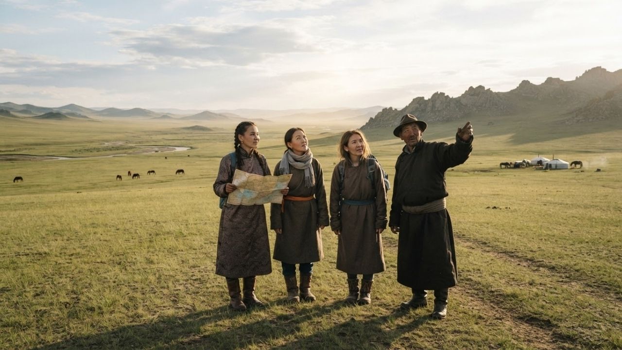
Image generated by AI
Wilderness explorers are increasingly disconnecting from satellite navigation devices to master ancestral wayfinding techniques taught by nomadic communities across four continents.
[ULAANBAATAR, Mongolia, Sept. 1, 2026] — A growing international movement in expedition travel is seeing adventurous trekkers abandon digital GPS screens in favor of traditional indigenous pathfinding. From reading micro-topography across the Mongolian steppe to tracking subterranean water systems in Oman’s deserts, navigating trade routes in Morocco, and interpreting equine instincts in the Kyrgyz mountains, travelers are rediscovering survival skills passed down through generations.
Expedition organizers report that demand for screen-free wilderness apprenticeships is rising as travelers seek authentic ecological literacy and self-sufficiency. By learning to interpret wind patterns, livestock behavior, celestial markers, and geological formations, trekkers are learning to safely conquer remote environments that lack cellular signals or electronic mapping infrastructure.
Mongolian Steppe Pathfinding: Reading Saiyrs, Ridge Lines, and Livestock Cues
In the expansive grasslands of Mongolia, nomadic herders navigate thousands of square miles of featureless terrain without ever relying on electronic maps or magnetic compasses.
Key environmental cues used by Mongolian nomads include:
- Micro-Topography and Dry Riverbeds (Saiyrs): Herders identify imperceptible landscape features, including ancient glacial swales, subtle terrain ridges, and dry riverbed channels (saiyrs), to maintain precise directional headings across vast horizons.
- Livestock Weather Behavior: Nomads monitor animal dispositions—noting how horses gather against prevailing wind directions or how cattle align their backs away from incoming rain fronts to predict meteorological shifts.
- Celestial Encampment Geometry: Encampments are oriented along fixed cardinal axes, allowing travelers to use yurt alignments and star positions for night-time dead reckoning.
These observational skills enable herder families to manage seasonal migrations across extreme wilderness expanses.
Omani Bedouin Desert Trajectories: Subterranean Water Tracking and Yardangs
In the Middle East, navigating the hyper-arid gravel plains and towering dunes of Oman’s Rub' al Khali desert requires specialized hydrological and geological knowledge.
Bedouin pathfinders rely on distinct environmental markers to guide desert expeditions:
- Faunal Water Indicators: Guides locate hidden subterranean water wells by tracking the dawn flight paths of sandgrouse birds, which travel directly toward water sources.
- Wind-Carved Yardangs: Prominent wind-eroded rock formations (yardangs) and distinct mineral color variations across rock strata serve as natural compass points where shifting sands erase surface footprints.
- Nocturnal Star Navigation: Clear desert night skies allow Bedouin navigators to use constellation angles for precise long-distance dead reckoning.
Moroccan Caravan Protocols and Kyrgyz Alpine Pass Navigation
Across North Africa and Central Asia, historical trade networks and mountain pastoralism rely on physical markers and biological partnerships:
Moroccan Caravan Routes
Traversing the steep relief of the Atlas Mountains and pre-Saharan oases in Morocco relies on an ancient network of fortified staging posts (fondouks) spaced precisely one day’s march apart. Expedition leaders verify their route through marine fossil layers exposed in limestone gorges and prominent salt deposit outcroppings.
Kyrgyz Tian Shan Mountain Treks
In Kyrgyzstan, high-altitude pastoral routes crossing alpine mountain passes above 3,000 meters require interpreting flora and equine instincts. Shepherds evaluate the bloom timing of alpine edelweiss to determine safe seasonal weather windows, while relying on packhorses' innate sensory abilities to avoid hidden boggy turf, scree slides, and thin glacial ice over rushing streams.
Comprehensive Data Breakdown: Global Ancestral Navigation Systems
The table below outlines the primary terrain types, indigenous environmental cues, and traditional navigation mechanics across four global regions:
| Regional Navigation System | Geographic Terrain Type | Primary Environmental & Biological Cues | Core Survival & Pathfinding Application |
|---|---|---|---|
| Mongolian Steppe Nomads | Open Grasslands & Ridge Lines | Micro-ridges, dry riverbeds (saiyrs), horse wind alignment | Long-distance seasonal herd migration without maps |
| Omani Bedouin Guides | Hyper-Arid Rub' al Khali Dunes | Sandgrouse flight paths, rock strata, wind-carved yardangs | Locating subterranean water wells & desert crossing |
| Moroccan Trade Caravans | Atlas Mountains & Sahara Oases | Fortified staging posts (fondouks), marine fossil layers | Measuring one day's march between water stations |
| Kyrgyz Alpine Shepherds | Tian Shan Passes (>3,000 meters) | Edelweiss bloom schedules, packhorse sensory instincts | Bypassing thin ice, boggy turf & high-altitude scree |
Why This Matters: Essential Takeaways for GPS-Free Wilderness Trekkers
For adventure travelers and backcountry explorers interested in practicing traditional wayfinding, these indigenous methods provide practical safety principles:
- Build Multi-Sensory Environmental Awareness: Before relying on digital devices, practice observing natural indicators—such as prevailing wind directions, sun angles, and stream drainage patterns—to maintain directional orientation.
- Understand Animal Instincts in Mountain Terrain: When trekking on horseback in high-altitude environments like the Tian Shan mountains, trust pack animals when they refuse to cross suspect ice or boggy terrain.
- Study Micro-Topography Before Entering Remote Areas: Map key geological landmarks, riverbed patterns, and rock outcroppings prior to entering regions devoid of cellular coverage.
- Carry Analogue Backups on Off-Grid Expeditions: Even when taking modern navigation gear, carry physical topographical maps, magnetic compasses, and analogue directional tools for emergency redundancy.
Frequently Asked Questions
What is GPS-free ancestral navigation?
GPS-free ancestral navigation refers to traditional wayfinding techniques that rely on observing natural environmental cues—such as micro-topography, wind directions, animal behavior, rock strata, and celestial bodies—rather than electronic satellite devices.
How do Mongolian herders navigate without maps?
Mongolian nomads navigate by reading subtle terrain ridges, dry riverbed channels (saiyrs), livestock weather alignments, and traditional yurt encampment orientations across the steppe.
What environmental cues do Bedouin guides use in Omani deserts?
Bedouin pathfinders locate hidden water wells by tracking sandgrouse bird flight paths at dawn, using wind-carved rock formations (yardangs), and navigating by night stars across shifting dunes.
How high are the mountain pass routes in the Kyrgyz Tian Shan?
Kyrgyz shepherds navigate alpine pass routes that frequently exceed 3,000 meters in elevation, relying on horse sensory acuity and flower bloom schedules to safely cross vertical wilderness zones.
Related Travel Guides
Disclaimer
This article is for informational and educational purposes only. It does not constitute legal, financial, or professional advice. While we strive to provide accurate and up-to-date information, travel policies, regulations, and conditions change rapidly. Always verify information with official sources before making travel decisions. Nomad Lawyer makes no representations about the accuracy, reliability, completeness, or suitability of the information provided. Readers should consult qualified professionals for advice specific to their circumstances. The views expressed in this article are those of the author and do not necessarily reflect the views of Nomad Lawyer.
Raushan Kumar
Founder & Lead Developer
Full-stack developer with 11+ years of experience and a passionate traveller. Raushan built Nomad Lawyer from the ground up with a vision to create the best travel and law experience on the web.
Learn more about our team →