
Category 2 Hurricane Nolo Sweeps South of Hawaii: 16-Inch Rain Warnings, Flash Floods, and Island Travel Status 2026

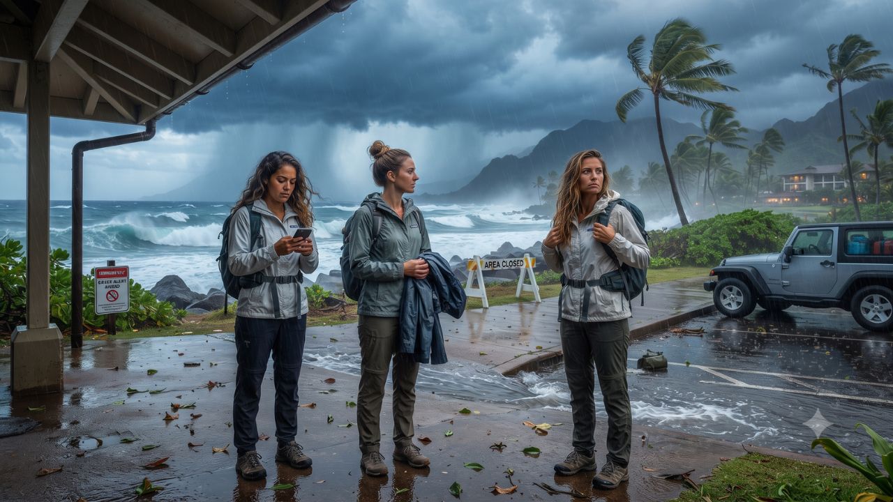
Even with its center passing offshore south of the archipelago, Category 2 Hurricane Nolo is funneling atmospheric moisture into Hawaii's volcanic peaks, triggering rainfall projections of up to 16 inches across eastern and southern districts of the Big Island. Critical meteorological bulletins from the National Hurricane Center and Central Pacific Hurricane Center (NOAA) confirm that the storm is packing maximum sustained winds of 105 mph (165 km/h) with a central pressure of 975 millibars, extending tropical-storm-force winds up to 140 miles from its core.
A pre-landfall Presidential Emergency Declaration has been officially approved for Honolulu, Hawaii, Maui, and Kauai counties, placing the Hawaii State Emergency Operations Center at full activation. While direct eye landfall is averted, the interaction between deep tropical moisture and dramatic volcanic elevation has initiated widespread state park shutdowns, trail closures, and high-surf warnings across the islands.
Meteorological Breakdown and Island-by-Island Weather Advisories
Understanding the localized distribution of rainfall, wind radii, and marine hazards is vital for anyone currently in Hawaii or planning immediate transit:
- Hawaii Island (Big Island Windward & Southern Zones): Positioned closest to Nolo's circulation, eastern and southern areas face 8 to 12 inches of rainfall, with localized mountain maximums reaching 16 inches (and earlier projections warning of isolated 25-inch accumulations). These conditions carry severe risks of life-threatening flash floods and debris flows in Kaʻū, Puna, and Hilo. A Hurricane Watch and Tropical Storm Warning remain active for Hawaii County.
- Hawaii Island (Leeward Western Zones): Sheltered partially beneath the rain shadow of Mauna Kea and Mauna Loa, western areas around Kailua-Kona and the Kohala Coast are forecast to receive 1 to 3 inches of rain, with localized peaks reaching 6 inches.
- Maui County (Maui, Molokai, Lanai): Under an active Tropical Storm Watch, Eastern Maui anticipates 4 to 6 inches of rain with isolated maximums of 8 to 10 inches along the slopes of Haleakalā. Saturated terrain along the Hana Highway presents elevated rockfall and landslide hazards.
- Wind Field Dimensions: Hurricane-force winds extend outward up to 45 miles from Nolo's center, while tropical-storm-force winds span a wide 140-mile radius, generating gusty mountain downdrafts across all islands.
- Ocean and Coastal Hazards: Severe swells generated by Nolo continue to batter south- and east-facing shorelines, prompting High Surf Advisories and hazardous rip current warnings that render ocean swimming and small boat navigation extremely dangerous.
Public Lands, State Parks, and Tourism Infrastructure Closures
State and county authorities have enacted extensive protective measures to safeguard residents and travelers:
- State Park Closures: According to the Hawaii Department of Land and Natural Resources (DLNR State Parks), all state parks, public camping grounds, and lodging facilities across Hawaii Island were closed effective September 24. Closures across Maui and Molokai state parks took effect on September 25.
- Forest Reserves and Trail Networks: All managed hiking trails under the Nā Ala Hele trail system and remote state forest reserves are closed until further notice. All existing camping permits have been suspended.
- Schools and Civic Facilities: Public schools and non-essential administrative offices across Hawaii County and Maui County introduced precautionary closures to support community shelter preparations.
- Aviation and Marine Operations: While major airport terminals in Honolulu (HNL), Kahului (OGG), Kona (KOA), and Hilo (ITO) remain structurally open, regional inter-island flights and tour charters face scheduling adjustments. Travelers must confirm departure times directly with operating airlines before traveling to airstrips.
What Makes Volcanic Weather Systems Uniquely Hazardous
The physical geography of the Hawaiian Islands creates atmospheric dynamics that differ fundamentally from continental landmasses.
When moisture-laden hurricane circulation encounters massive 10,000-to-13,000-foot volcanic massifs, the air is forced upward in a process known as orographic lift. This rapid ascent condenses water vapor into concentrated, torrential downpours over high-elevation watersheds.
Because island riverbeds are narrow, steep, and cut through volcanic basalt, torrential rainfall transforms dry gulches into roaring flash floods within minutes. Furthermore, heavy soil saturation destabilizes steep canyon walls, causing sudden mudslides and debris slides that can sever isolated coastal highways long after visible storm clouds pass.
Visitor Insider Tips for Managing Severe Weather in Hawaii
Navigating severe storm advisories safely requires immediate adjustments to daily routines:
- Obey Park Closures and Warning Signs Strictly: Never attempt to bypass locked gates or warning tape at state park trailheads like Akaka Falls or ʻĪao Valley. Flash floods and falling rock hazards in steep volcanic gulches develop without audible warning.
- Monitor Civil Defense Radio and Text Alerts: Register your smartphone for Hawaii County Civil Defense and Maui Emergency Management Agency emergency notifications to receive localized road closure alerts in real time.
- Stay Clear of South-Facing Shorelines: Even during periods of calm sunshine between outer rain bands, large ocean swells and lethal rip currents generated by offshore storms can sweep beachgoers off rocky outcroppings and sandbars.
- Do Not Drive Through Moving Water: Never attempt to drive through flooded dips in the road or ford running streams along rural routes like Highway 11 or the Hana Highway. Moving water six inches deep can stall passenger vehicles and carry cars off roadway shoulders.
- Utilize Hotel Concierge Services for Activity Rebooking: Consult with resort staff regarding safe indoor cultural activities, museum visits, and airline waiver rebooking procedures promoted through GoHawaii.
Cultural and Environmental Context: Community Resilience and Mālama
For native Hawaiians, tropical storms (makani pahulu) are recognized as powerful natural processes that cleanse and replenish island watersheds (ahupuaʻa), recharging freshwater aquifers that sustain island life throughout dry summer months.
In times of environmental stress, local communities rally around the concept of laulima—cooperation and communal assistance. Neighbors clear drainage culverts, secure fishing skiffs, and support elderly residents in rural valleys.
Visitors are encouraged to embody mālama by demonstrating patience with hospitality staff, strictly adhering to county travel advisories, avoiding unnecessary driving that could divert emergency first responders, and allowing municipal teams to inspect and clear roadways safely.
FAQ: Hurricane Nolo Hawaii Travel Advisory 2026
Is it safe to stay in Hawaii hotels during Hurricane Nolo?
Yes. Modern resort and hotel structures across Hawaii are built to stringent hurricane safety codes. Follow on-site property management directives and remain indoors during peak wind and rain bands.
Are inter-island flights between Oahu, Maui, and Kona operating?
Major airlines maintain operations subject to weather conditions, but regional turboprop schedules and helicopter tours face delays. Check with Hawaiian Airlines or Southwest for active travel waivers.
When are Hawaii state parks and hiking trails expected to reopen?
DLNR forestry and park crews must conduct post-storm safety inspections for downed trees, landslides, and trail washouts before reopening facilities. Check DLNR advisories for daily status updates.
Can I swim in resort pools or calm bays during the advisory?
Outdoor pool decks and beach access points may close temporarily during high winds and lightning. Do not enter the ocean along southern or eastern shores during active High Surf Advisories.
By respecting the immense power of Pacific storms and listening to local guidance, travelers navigate unexpected weather with confidence and care.
Related Travel Guides
Disclaimer
This article is for informational and educational purposes only. It does not constitute legal, financial, or professional advice. While we strive to provide accurate and up-to-date information, travel policies, regulations, and conditions change rapidly. Always verify information with official sources before making travel decisions. Nomad Lawyer makes no representations about the accuracy, reliability, completeness, or suitability of the information provided. Readers should consult qualified professionals for advice specific to their circumstances. The views expressed in this article are those of the author and do not necessarily reflect the views of Nomad Lawyer.
Kunal K Choudhary
Co-Founder & Contributor
A passionate traveller and tech enthusiast. Kunal contributes to the vision and growth of Nomad Lawyer, bringing fresh perspectives and driving the community forward.
Learn more about our team →