
Bolivia Rebalances Salar de Uyuni Tourism and Global Lithium Extraction

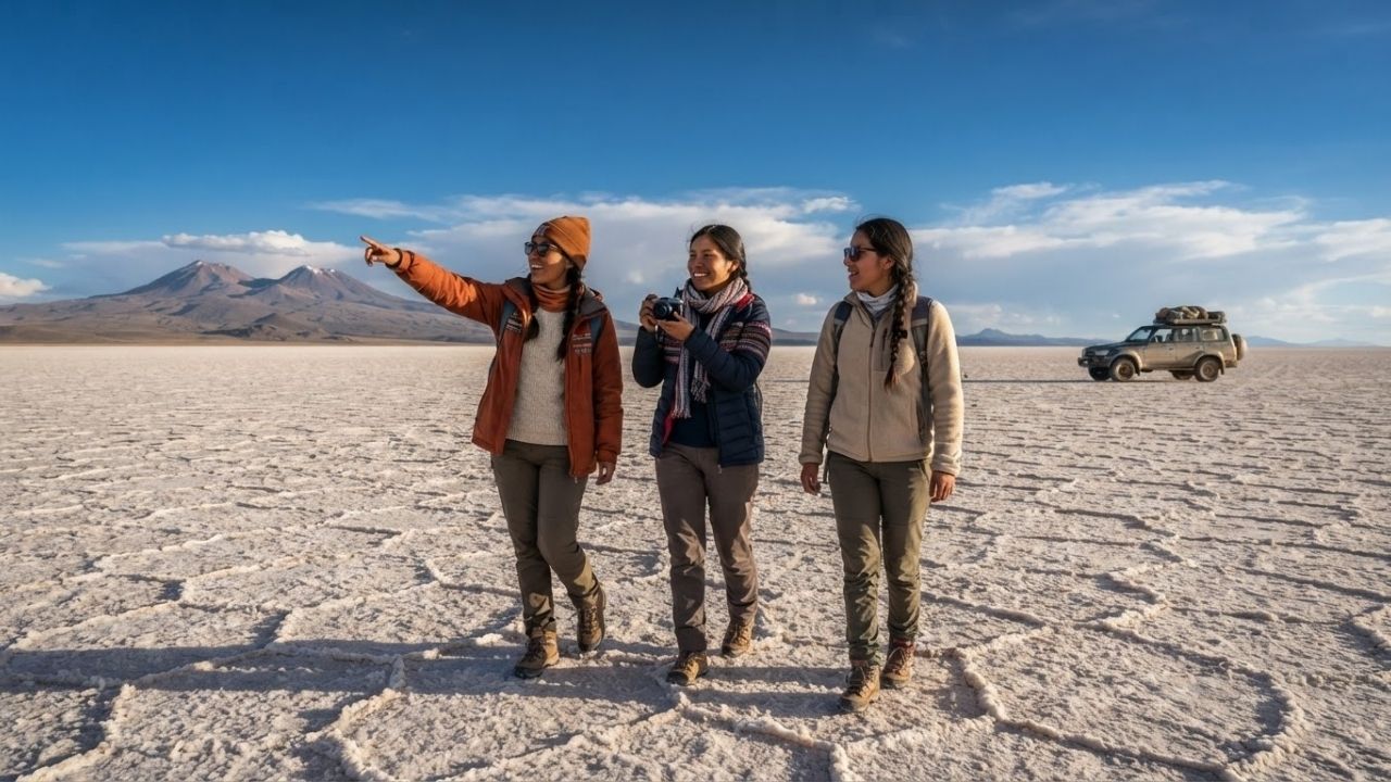
Image generated by AI
Bolivia has implemented updated environmental and tourism management regulations across the 10,582-square-kilometer Salar de Uyuni, balancing international visitor demand with global lithium extraction.
[UYUNI, Bolivia, Sept. 1, 2026] — Located in the Daniel Campos Province of the Potosí Department across the high Bolivian Altiplano, Salar de Uyuni stands as the world's largest salt flat, covering approximately 10,582 square kilometers. Formed by the desiccation of prehistoric Late Pleistocene lakes, the basin features a dense salt crust several meters thick over a rich subterranean brine pool containing a major share of the global lithium reserves essential for electric vehicle batteries.
Regional authorities are enforcing structured guidelines for 4WD tour operators to protect the ecosystem while maintaining its dual role as a high-altitude tourism destination and a critical satellite calibration zone. Positioned at an elevation exceeding 3,600 meters above sea level, the salt flat continues to attract global travelers seeking seasonal mirror-reflection phenomena and high-altitude wilderness landscapes.
Geological Origins: Prehistoric Lake Evaporation and Satellite Calibration
Salar de Uyuni's origin dates back to the gradual evaporation of massive prehistoric lakes that covered the high Andes plateau thousands of years ago.
Key geological features include:
- Evaporitic Salt Crust: An exceptionally hard crust averaging several meters in thickness rests above a dense pool of mineral-rich liquid brine.
- Extreme Surface Flatness: The uniform elevation variance across thousands of square kilometers makes Salar de Uyuni one of the flattest surfaces on Earth, serving as a calibration target for Earth observation satellites.
- Altiplano Biodiversity: Despite harsh saline conditions, the ecosystem supports breeding colonies of Andean flamingo species, while regional towns like Colchani operate traditional salt harvesting cooperatives.
Seasonal Transformations: Mirror Reflections Versus Hexagonal Salt Patterns
Travelers to Salar de Uyuni encounter distinct seasonal landscapes depending on the time of year:
Wet Season (December to April)
Accumulated rainwater forms a thin water sheet across the hard salt crust, transforming the landscape into a vast natural mirror reflecting the sky and clouds. While visually famous for photography, deep standing water can restrict vehicular access across central sectors.
Dry Season (May to November)
The water layer evaporates completely, exposing geometric hexagonal salt crust patterns across the floor. During these dry months, specialized 4WD vehicles can cross the interior, linking Uyuni to remote islands like Isla Incahuasi and the surrounding high-altitude lagoons.
Strategic Economic Balance: Eco-Tourism and Global Lithium Reserves
Beyond its tourism value, Salar de Uyuni holds immense industrial significance:
- World's Largest Lithium Pool: The subterranean brine beneath the salt crust holds a major share of global lithium reserves, vital for electric vehicle manufacturing, consumer electronics, and energy storage.
- Sustainable Mining Controls: Industrial extraction policies focus on closed-loop brine evaporation methods to prevent structural damage to the salt crust or contamination of local water tables.
- Regional Economic Integration: Managed 4WD overland expeditions connect Salar de Uyuni with the Eduardo Avaroa Andean Fauna National Reserve, supporting local guides, hostels, and salt-block hotels in gateway towns like Uyuni and Colchani.
Comprehensive Data Breakdown: Salar de Uyuni Parameters and Seasons
The table below outlines key geographical, environmental, and geological metrics for Salar de Uyuni:
| Geographic & Environmental Metric | Official Field Parameter / Value | Strategic & Ecological Significance |
|---|---|---|
| Total Surface Area | Approximately 10,582 square kilometers | World's largest evaporitic salt flat basin |
| Altiplano Elevation | Exceeds 3,600 meters above sea level | High-altitude environment requiring acclimatization |
| Geographic Location | Daniel Campos Province, Potosí Department, Bolivia | High plateau region of the Bolivian Andes |
| Subsurface Mineral Content | Brine pool rich in lithium & potassium | Major share of global lithium reserves for batteries |
| Primary Satellite Function | Orbital Earth observation calibration target | Used by international space agencies for radar altimetry |
The table below contrasts travel logistics across the wet and dry Altiplano seasons:
| Seasonal Parameter | Wet Season (December to April) | Dry Season (May to November) |
|---|---|---|
| Visual Landscape | Sky-mirror reflection effect on standing water | Dry hexagonal salt crust lattice patterns |
| 4WD Vehicle Mobility | Restricted to shallow perimeter areas | Full interior transit across central salt crust |
| Night Temperatures | Cold, mild freezing sub-zero drops | Extreme sub-zero nighttime temperatures |
| Recommended Gear | Waterproof boots & high-UV eye protection | Thermal layering, windbreakers & sunblock |
Why This Matters: Essential Takeaways for Altiplano Travelers
For travelers planning an expedition to Salar de Uyuni, these operational facts provide essential safety and logistical advice:
- Plan Acclimatization for 3,600-Meter Altitude: Spend two to three days in La Paz or Uyuni prior to salt flat excursions to prevent acute mountain sickness (AMS) caused by high elevation.
- Prepare Thermal Layering and UV Protection: Extreme diurnal temperature drops mean daytime UV exposure gives way to sub-zero freezing conditions after dark. Pack heavy thermal clothing and category-4 sunglasses.
- Carry Physical Currency: Electronic payment infrastructure is virtually absent in remote Altiplano settlements and salt hotels. Bring sufficient Bolivian Bolivianos (BOB) cash.
- Book Certified 4WD Operators: Ensure your tour company uses well-maintained four-wheel-drive vehicles equipped with emergency satellite communications and oxygen supplies.
Frequently Asked Questions
Where is Salar de Uyuni located?
Salar de Uyuni is located in southwestern Bolivia, within the Daniel Campos Province of the Potosí Department, across the high Andean Altiplano.
When is the best time to see the mirror effect on Salar de Uyuni?
The famous mirror reflection effect occurs during the wet season, from December to April, when a thin layer of rainwater covers the flat salt crust.
Why is Salar de Uyuni economically important for lithium?
The subterranean brine pool beneath the salt crust contains one of the world's largest reserves of lithium, a mineral essential for electric vehicle batteries and green energy storage.
What unique lodging options exist near Salar de Uyuni?
Gateway towns like Colchani feature hotels built almost entirely from locally harvested salt blocks, including salt brick walls, tables, and bed frames.
Related Travel Guides
Disclaimer
This article is for informational and educational purposes only. It does not constitute legal, financial, or professional advice. While we strive to provide accurate and up-to-date information, travel policies, regulations, and conditions change rapidly. Always verify information with official sources before making travel decisions. Nomad Lawyer makes no representations about the accuracy, reliability, completeness, or suitability of the information provided. Readers should consult qualified professionals for advice specific to their circumstances. The views expressed in this article are those of the author and do not necessarily reflect the views of Nomad Lawyer.
Raushan Kumar
Founder & Lead Developer
Full-stack developer with 11+ years of experience and a passionate traveller. Raushan built Nomad Lawyer from the ground up with a vision to create the best travel and law experience on the web.
Learn more about our team →