
10 Best New Zealand South Island Road Trips Reddit Travelers Recommend in 2026
Planning an unforgettable New Zealand South Island road trip in 2026? Reddit travelers on r/newzealand rank the top 10 scenic routes, from the Milford Road and Mount Cook to the rugged West Coast and Southern Scenic Route.

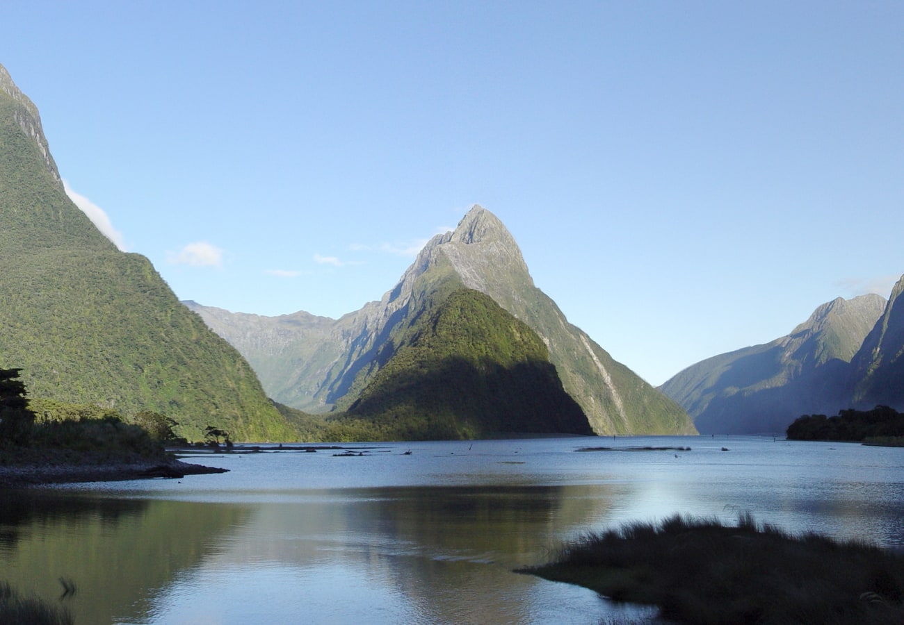
Mitre Peak towering 1,692 meters directly out of the glaciated waters of Milford Sound in Fiordland National Park
With glaciated alpine peaks piercing the clouds, turquoise glacial lakes framed by purple lupins, and subtropical rainforests tumbling into roaring ocean surf, New Zealand’s South Island (Te Waipounamu) is widely recognized as the undisputed road trip capital of the Southern Hemisphere. Compact yet endlessly dramatic, every mountain pass and coastal highway feels like stepping into a cinematic fantasy landscape.
Drawing upon thousands of firsthand travel reports, seasonal weather alerts, and freedom camping discussions across r/newzealand, r/roadtrip, and r/travel, here is the definitive guide to the 10 best New Zealand South Island road trips for 2026.
Mitre Peak towering 1,692 meters directly out of the glaciated waters of Milford Sound in Fiordland National Park.
1. The Classic South Island Grand Loop (Christchurch to Queenstown & The West Coast)
The undisputed king of Kiwi road trips, the South Island Grand Loop connects the Canterbury Plains, the southern Southern Alps, the adventure capital of Queenstown, and the wild rainforests of the West Coast in one continuous, epic circuit.
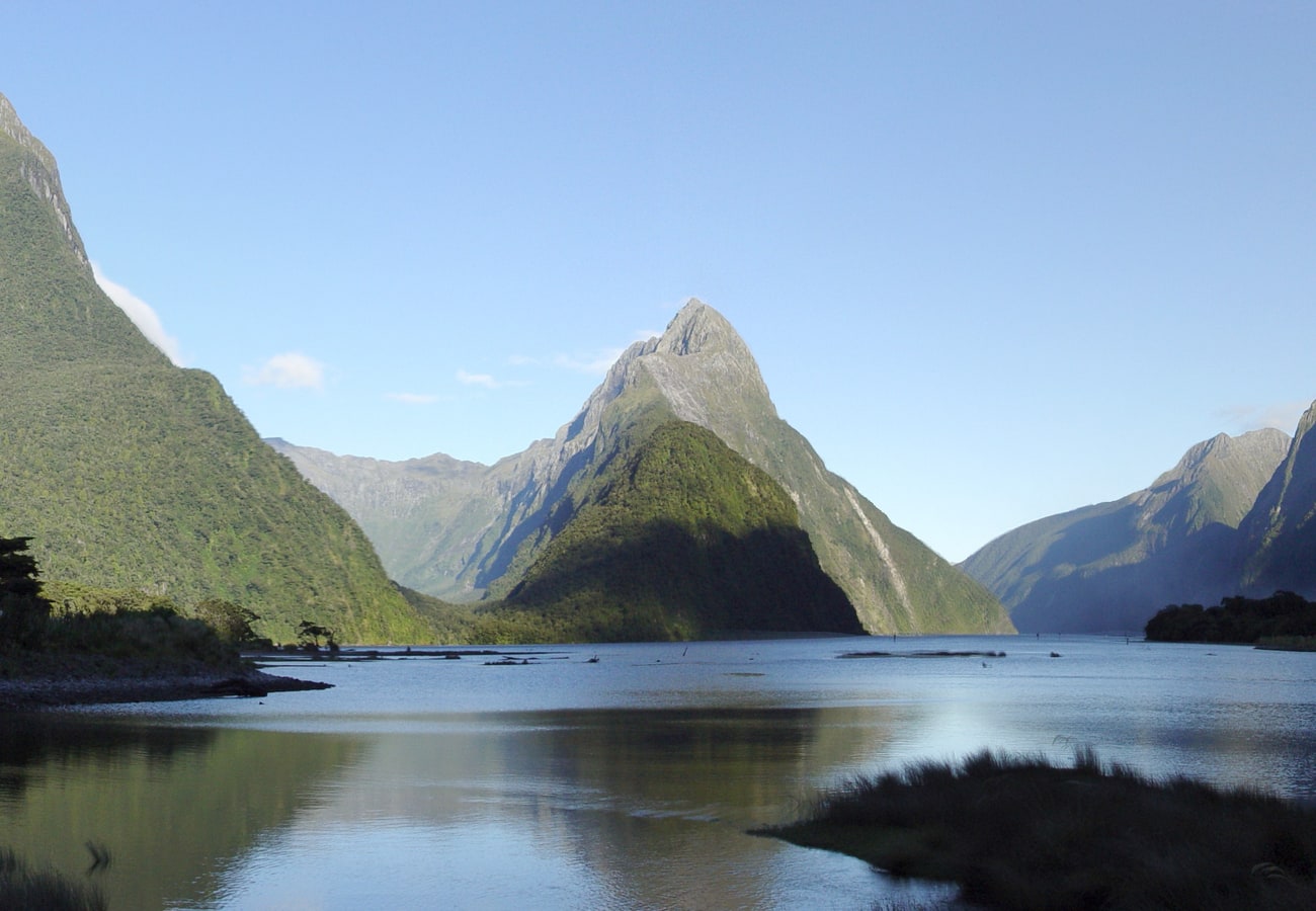 Sheer glaciated fjord cliffs and cascading waterfalls in Fiordland National Park.
Starting in Christchurch, drivers cross Arthur's Pass to the rugged Tasman Sea coast, journey south through glacier country (Franz Josef and Fox Glaciers), traverse Haast Pass into the golden tussock hills of Wanaka and Queenstown, and return north past Lake Tekapo and Mount Cook. Reddit travelers advise allocating at least two full weeks to complete the loop without driving fatigue, allowing spontaneous stops for glacier heli-hikes, jet-boating, and hot spring soaks.
- Distance: ~1,850 km (1,150 miles)
- Recommended Time: 14 to 21 days
- Best Season: November to April (summer through early autumn)
- Reddit Tip: Download the CamperMate app to locate approved freedom camping sites, dump stations, and freshwater taps across the island.
2. Queenstown to Glenorchy & Paradise (Lake Wakatipu Highway)
Hugging the jagged eastern shoreline of Lake Wakatipu for 46 kilometers, the drive from Queenstown to Glenorchy is universally celebrated on Reddit as one of the most stunning 45-minute drives on Earth.
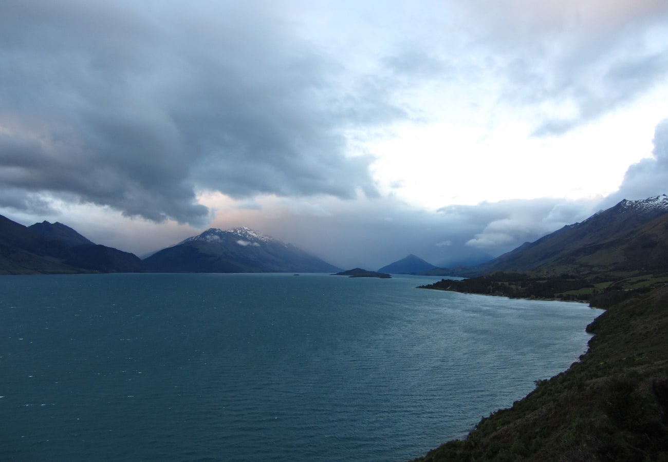 Dramatic alpine mountain silhouettes reflected across the glacial waters of Lake Wakatipu.
The road curves beneath the towering crags of the Remarkables and Cecil Peak before entering the sleepy lakeside village of Glenorchy, famed for its iconic red wooden boat shed. Beyond Glenorchy, the road transitions into a graded gravel track winding into the Dart River Valley and the hamlet aptly named "Paradise"—a pristine beech forest valley used extensively for filming Peter Jackson’s Lord of the Rings trilogy.
- Distance: 46 km (28 miles) paved to Glenorchy; 68 km total to Paradise
- Recommended Time: Half to full day
- Best Season: Year-round
- Reddit Tip: Stop at Bennett’s Bluff lookout halfway between Queenstown and Glenorchy for an elevated vantage point over the turquoise expanse of Lake Wakatipu and the Humboldt Mountains.
3. The Crown Range Road (Queenstown to Wanaka)
Reaching an elevation of 1,076 meters (3,530 feet), the Crown Range Road is the highest paved public highway in New Zealand, offering a thrilling alpine shortcut between Queenstown and Wanaka.
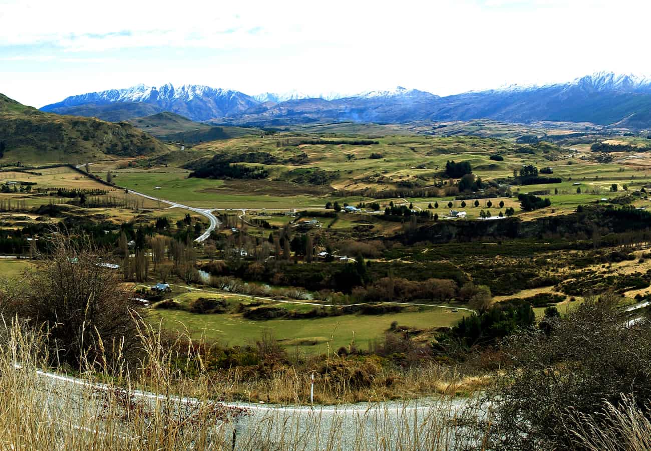 The high-altitude switchbacks and golden tussock peaks of the Crown Range Road.
The drive begins with a series of steep, sharp zig-zag switchbacks climbing out of the Arrowtown basin, providing bird's-eye views over Queenstown airport and Lake Wakatipu. After summiting the alpine pass, the road descends into the historic Cardrona Valley. Pull in for a pint of craft ale or hot mulled wine at the historic 1863 Cardrona Hotel—one of New Zealand's oldest and most photogenic pubs.
- Distance: 69 km (43 miles)
- Recommended Time: 2 to 3 hours
- Best Season: November to April (winter requires snow chains and alpine driving care)
- Reddit Tip: If you are driving a large motorhome or campervan, ensure your brakes are in excellent condition; use low gear when descending the steep Crown Terrace switchbacks to prevent brake fade.
4. Lake Pukaki to Aoraki / Mount Cook (State Highway 80)
State Highway 80 follows the western edge of Lake Pukaki straight toward the soaring glaciated crown of Aoraki / Mount Cook, New Zealand's highest mountain (3,724 meters).
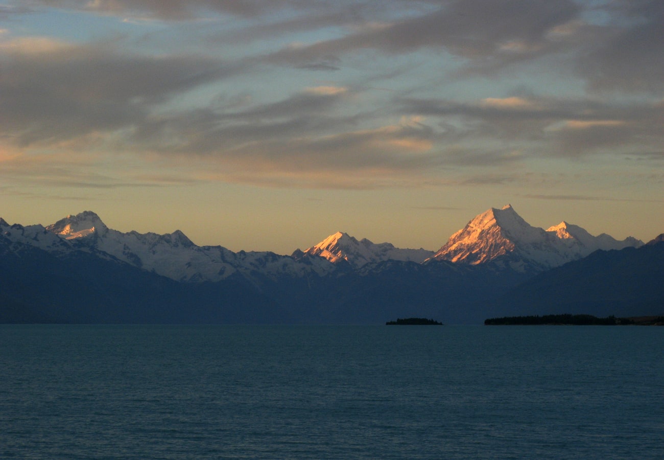 The blinding turquoise glacial flour of Lake Pukaki framing the snowfields of Aoraki / Mount Cook.
Lake Pukaki gets its surreal, milky-turquoise coloration from glacial flour—extremely fine silt suspended in melted glacier water that scatters sunlight. As you drive along Highway 80, Mount Cook looms larger with every mile. The road terminates in Mount Cook Village, the trailhead for the world-renowned Hooker Valley Track, where three swing bridges lead to iceberg-filled glacial terminal lakes.
- Distance: 55 km (34 miles)
- Recommended Time: Full day
- Best Season: October to April
- Reddit Tip: Stop at the Mount Cook Alpine Salmon shop on the southern shore of Lake Pukaki for the freshest sashimi on the South Island, served directly beside the turquoise water.
5. The Rugged West Coast Highway (Haast Pass to Westport via State Highway 6)
State Highway 6 through the West Coast is an untamed coastal corridor wedged between the crashing surf of the Tasman Sea and the vertical rain-forested ramparts of the Southern Alps.
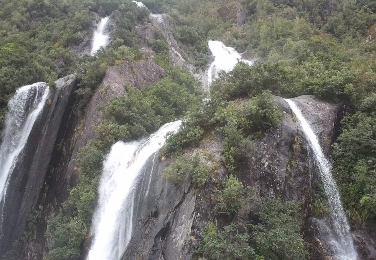 Ancient temperate rainforest canopies hugging the wild coastline of New Zealand's West Coast.
Beginning at Haast Pass—where roaring glacial torrents plunge through Thunder Creek Falls and the Blue Pools of Haast—the highway pushes north past the retreating ice tongues of Fox and Franz Josef Glaciers. North of Greymouth, the road is carved into coastal limestone cliffs, passing the blowholes and layered limestone towers of the Punakaiki Pancake Rocks.
- Distance: 450 km (280 miles)
- Recommended Time: 3 to 5 days
- Best Season: January to April (driest coastal conditions)
- Reddit Tip: Fiordland and West Coast sandflies (namu) are relentless near still water and rainforests. Normal insect repellents do not work; purchase local DEET-heavy repellents like "Ooff!" or "Bushman" immediately upon arrival.
6. Arthur’s Pass Alpine Highway (Christchurch to Greymouth via State Highway 73)
State Highway 73 cuts directly across the Southern Alps via Arthur’s Pass (920 meters), connecting the arid sheep ranches of the east with the misty temperate rainforests of the west.
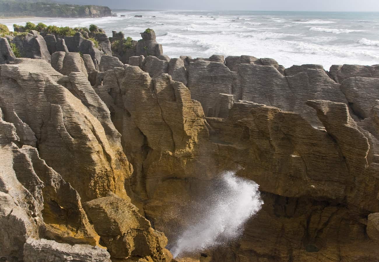 Layered limestone pancake rocks and crashing surge pools along the Tasman Sea coast.
The eastern ascent passes Castle Hill (Kura Tawhiti), where enormous limestone boulders jut out of rolling alpine meadows—a sacred site for the Ngāi Tahu and a world-class bouldering playground. As the highway crosses the dramatic Otira Viaduct, keep an eye out for the Kea—the world’s only alpine parrot. These hyper-intelligent birds frequently land on car mirrors and try to chew the rubber wipers off parked vehicles.
- Distance: 245 km (152 miles)
- Recommended Time: 1 to 2 days
- Best Season: November to April
- Reddit Tip: Never feed the kea under any circumstance. Human food makes them sick and teaches them dangerous roadside foraging behaviors.
7. The Southern Scenic Route & The Catlins (Dunedin to Te Anau)
For travelers seeking untouched, rugged coastlines devoid of tourist crowds, the Southern Scenic Route through The Catlins region on the southeastern coast is a hidden gem.
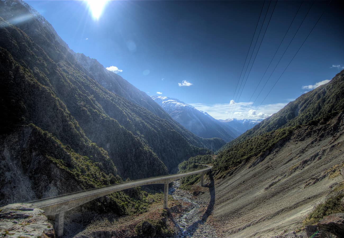 Towering beech forests and rugged alpine peaks framing Arthur's Pass.
The route connects Dunedin’s Scottish Victorian architecture with the fjordlands of Te Anau. Along the way, stop at Curio Bay to walk across a 180-million-year-old Jurassic fossilized forest embedded in the tidal rock platform, look for rare yellow-eyed penguins (hoiho) waddling ashore at dusk, and hike out to the windswept promontory of Nugget Point Lighthouse.
- Distance: 610 km (380 miles)
- Recommended Time: 3 to 4 days
- Best Season: December to March
- Reddit Tip: The Catlins experiences dramatic Southern Ocean gales. Pack windproof waterproof jackets even in the height of summer.
8. Nugget Point to Te Anau via The Catlins Coastal Highlights
Perched high above the Pacific Ocean, the lighthouse at Nugget Point looks down upon sharp wave-swept rock islets resembling gold nuggets, where fur seals and sea lions bask in the surf.
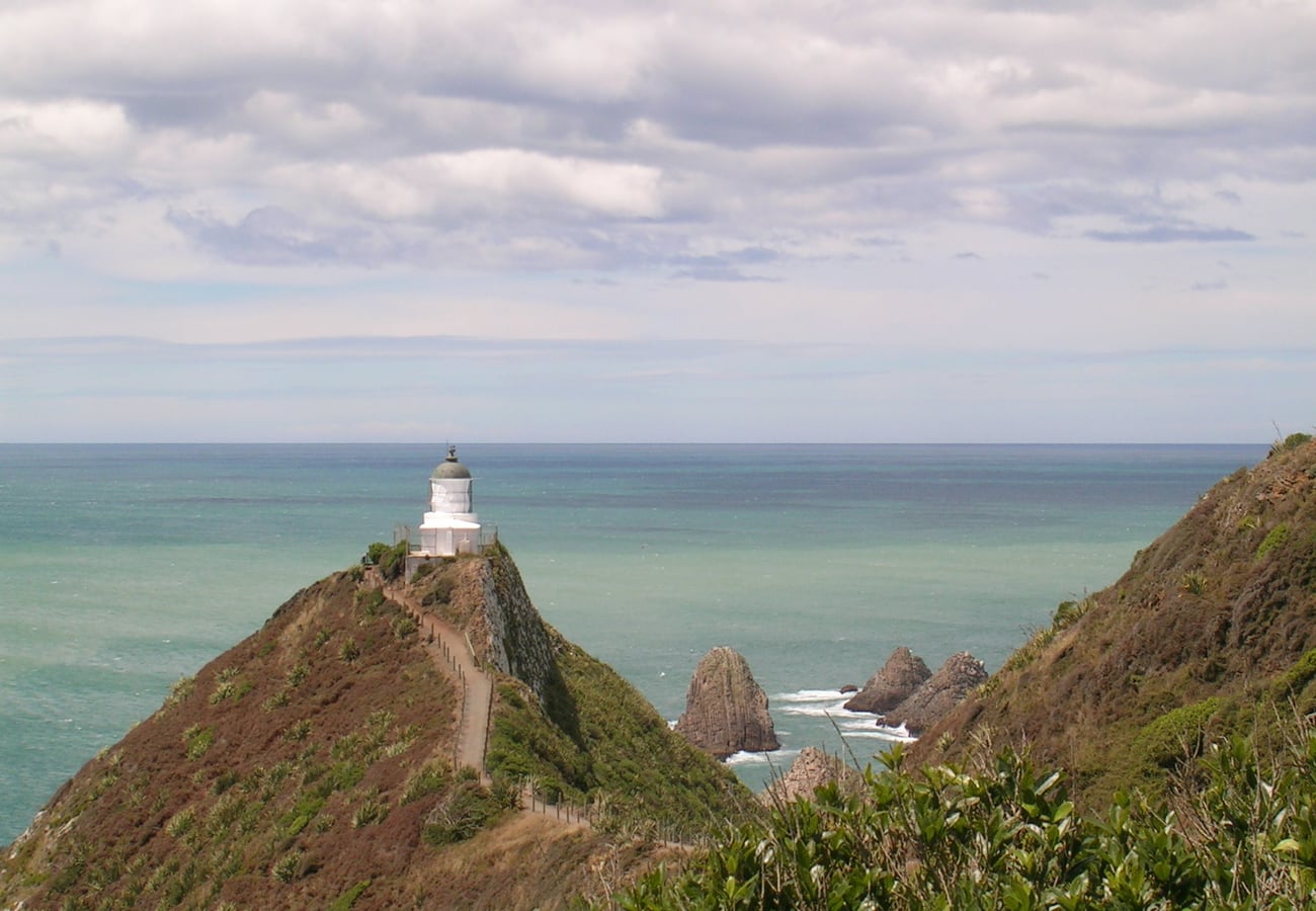 Nugget Point Lighthouse perched on dramatic coastal bluffs overlooking jagged rock nuggets.
Continuing west toward Invercargill and Te Anau, the route stops at Purakaunui Falls—a stunning three-tiered cascade shrouded in native beech and podocarp forest—and slope point, the southernmost point of the South Island where coastal trees are permanently bent horizontal by relentless Antarctic winds.
- Distance: 220 km (137 miles)
- Recommended Time: 2 days
- Best Season: November to April
- Reddit Tip: Stop at the famous Lost Gypsy Gallery in Papatowai for whimsical, wind-up kinetic automata created by artist Blair Somerville.
9. The Lindis Pass & Central Otago Scenic Highway (Wanaka to Christchurch)
Linking Central Otago with the Mackenzie Basin, State Highway 8 over the Lindis Pass (971 meters) is one of the most uniquely textured mountain drives in New Zealand.
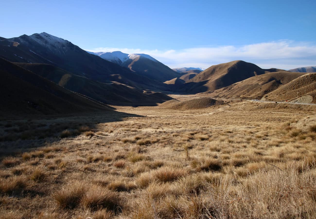 Sweeping golden tussock hills sculpted by glaciers and wind across the Lindis Pass.
The pass is famed for its treeless, velvety slopes covered in golden snow tussock (Chionochloa), which look like giant rippling velvet blankets in early morning and late evening light. In winter, the golden tussock is dusted in pure white snow, creating a stark, high-contrast monochrome landscape. Along the descent, the road winds through Cromwell’s renowned stone fruit orchards and Central Otago Pinot Noir vineyards.
- Distance: 180 km (112 miles)
- Recommended Time: Half day
- Best Season: October to April (golden tussock) or July to August (snow scenery)
- Reddit Tip: Pull into the summit lookout car park for panoramic photography over the winding ribbon of highway descending into the valley.
10. Kaikoura Coastal Highway (Picton to Christchurch via State Highway 1)
Winding along the narrow shelf between the sheer seaward Kaikoura mountain range and the Pacific Ocean, State Highway 1 provides South Island road trippers with unparalleled marine encounters.
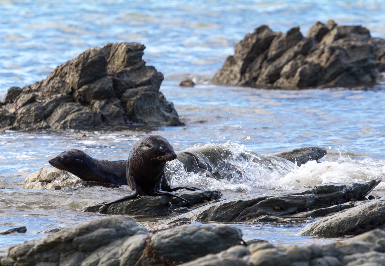 A native New Zealand fur seal lounging on tidal boulders directly along the Kaikoura coast.
Just offshore, the underwater Kaikoura Canyon drops to depths exceeding 1,000 meters, creating upwelling nutrient-rich currents that attract giant sperm whales, dusky dolphins, and wandering albatrosses year-round. Along the highway, travelers can park at Ohau Point to watch hundreds of wild New Zealand fur seals and their playful pups frolic in tidal pools just meters from the roadside walkway.
- Distance: 340 km (211 miles)
- Recommended Time: 2 days
- Best Season: November to April
- Reddit Tip: Stop at one of the roadside seafood caravans—such as the famous Kaikoura Seafood BBQ kiosk—for fresh local crayfish (rock lobster), grilled scallops, and whitebait fritters.
New Zealand South Island Road Trips Comparison
| Road Trip Route | Start & End Point | Distance | Duration | Key Attraction | Best Season |
|---|---|---|---|---|---|
| South Island Grand Loop | Christchurch Loop | 1,850 km | 14–21 Days | Glaciers, fjords & alpine passes | Nov – Apr |
| Queenstown to Glenorchy | Queenstown to Paradise | 68 km | Half Day | Lake Wakatipu & Lord of the Rings sets | Year-Round |
| Crown Range Road | Queenstown to Wanaka | 69 km | 2–3 Hours | Highest paved pass & Cardrona Hotel | Nov – Apr |
| Lake Pukaki to Mount Cook | Twizel to Mount Cook Village | 55 km | Full Day | Milky-blue lake & Hooker Valley hike | Oct – Apr |
| West Coast Highway (SH6) | Haast to Westport | 450 km | 3–5 Days | Glaciers & Pancake Rocks blowholes | Jan – Apr |
| Arthur’s Pass Highway | Christchurch to Greymouth | 245 km | 1–2 Days | Otira Viaduct & alpine Kea parrots | Nov – Apr |
| The Catlins Coastal Route | Dunedin to Invercargill | 610 km | 3–4 Days | Jurassic fossil forest & yellow-eyed penguins | Dec – Mar |
| Nugget Point to Te Anau | Nugget Point to Te Anau | 220 km | 2 Days | Historic lighthouse & Purakaunui Falls | Nov – Apr |
| Lindis Pass Highway | Wanaka to Omarama | 180 km | Half Day | Velvety golden tussock alpine slopes | Oct – Apr |
| Kaikoura Coastal Drive | Picton to Christchurch | 340 km | 2 Days | Sperm whale cruises & Ohau seal colony | Nov – Apr |
Essential Tips for Driving in New Zealand
- Drive on the Left: New Zealand adheres to left-side driving. The driver sits on the right. When navigating the South Island’s numerous roundabouts, always give way to the right and indicate your exit clearly.
- Single-Lane Bridges: The South Island features hundreds of single-lane wooden and concrete bridges. Pay close attention to the red and black circular/rectangular bridge signs: the large white arrow has right of way; the small red arrow indicates you must stop and give way to oncoming vehicles.
- Double Your Driving Time Estimates: Google Maps driving times assume you are driving at the maximum posted limit on straight roads. The South Island’s narrow, winding topography, steep gradients, and scenic photo stops mean journeys routinely take 30% to 50% longer than GPS estimates.
- Winter Snow Chains: If traveling between May and October, you are legally required to carry fitted snow chains in your vehicle when traversing alpine corridors (Crown Range, Arthur’s Pass, Milford Road, and Lindis Pass).
Frequently Asked Questions
Which direction is best to drive the South Island loop: clockwise or counter-clockwise?
Reddit travelers overwhelmingly recommend driving clockwise (Christchurch -> Arthur’s Pass -> West Coast -> Wanaka/Queenstown -> Mount Cook -> Christchurch). This direction places the morning light behind you on the West Coast, allows you to build anticipation toward the breathtaking climax of Queenstown and Mount Cook, and avoids traveling directly into the glaring afternoon sun along Highway 8.
Do I need to rent a campervan to road trip the South Island?
While campervans and motorhomes offer unmatched flexibility for staying at Department of Conservation (DOC) scenic campsites, they are not strictly required. The South Island has an extensive network of motels, holiday parks, and boutique lodges in every town. If renting a campervan, ensure it is Certified Self-Contained (CSC) to take advantage of freedom camping laws.
How many days are needed for a comprehensive South Island road trip?
Reddit veterans strongly advise at least 14 days to cover both the West Coast and the Central Otago/Canterbury alpine lakes without burning out. If you only have 7 to 10 days, focus exclusively on a Southern Alps hub-and-spoke itinerary centered around Queenstown, Wanaka, and Mount Cook.
Related Travel Guides
- 10 Best Australia Road Trips Reddit Travelers Recommend in 2026
- 10 Best Sydney to Melbourne Road Trip Stops Reddit Travelers Recommend in 2026
- 10 Best Cross-Country USA Road Trips Reddit Travelers Recommend in 2026
- 10 Best Scenic Drives for a USA Bucket-List Road Trip Reddit Travelers Recommend in 2026
Disclaimer
This article is for informational and educational purposes only. It does not constitute legal, financial, or professional advice. While we strive to provide accurate and up-to-date information, travel policies, regulations, and conditions change rapidly. Always verify information with official sources before making travel decisions. Nomad Lawyer makes no representations about the accuracy, reliability, completeness, or suitability of the information provided. Readers should consult qualified professionals for advice specific to their circumstances. The views expressed in this article are those of the author and do not necessarily reflect the views of Nomad Lawyer.
Raushan Kumar
Founder & Lead Developer
Full-stack developer with 11+ years of experience and a passionate traveller. Raushan built Nomad Lawyer from the ground up with a vision to create the best travel and law experience on the web.
Learn more about our team →